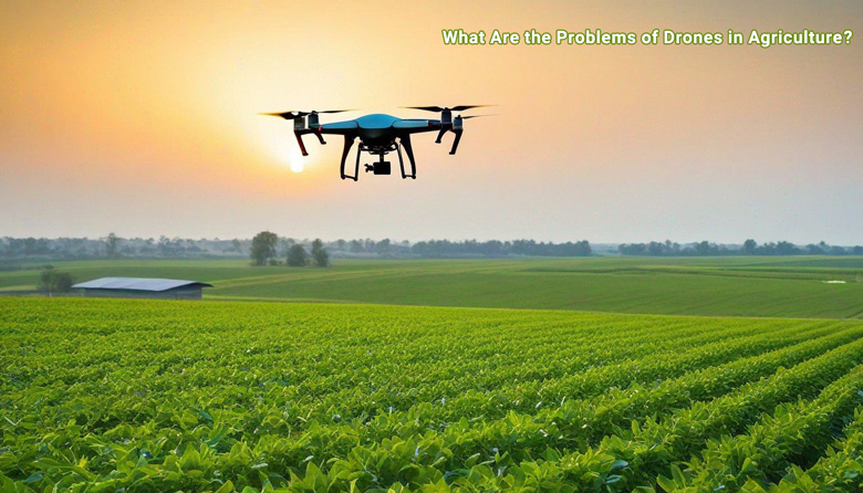
Precision agriculture, aiming for optimized crop yields and resource management, increasingly relies on drone technology. However, widespread adoption faces significant hurdles. From technical limitations in data acquisition and integration to regulatory obstacles and operational complexities, the transition isn’t without its challenges. This analysis delves into the key impediments to widespread drone use in agricultural settings.
The diverse challenges span technological limitations, including flight time, payload capacity, and sensor accuracy, impacting data reliability. Maintaining consistent data acquisition across varying agricultural terrains presents a significant hurdle. Furthermore, integrating drone data with existing agricultural software poses a complex technical challenge. Effective communication between drones and ground control stations is also crucial for real-time data transmission.
Technological Limitations
Drone adoption in precision agriculture faces significant hurdles, primarily stemming from the inherent limitations of current drone technology. While drones offer promising capabilities, their practical application is constrained by factors like flight time, payload capacity, sensor accuracy, and integration with existing systems. Overcoming these challenges is crucial for realizing the full potential of drone-based precision agriculture solutions.
Flight Time and Payload Capacity
Current drone models often have limited flight times, restricting the area they can cover in a single mission. This necessitates multiple flights for large agricultural fields, increasing operational costs and potentially impacting the efficiency of data collection. Furthermore, the payload capacity of drones is frequently insufficient to carry the necessary sensors and equipment for comprehensive analysis, potentially hindering the accuracy and depth of data gathered.
For example, a drone with a limited battery life might struggle to cover a vast vineyard in a single day, requiring multiple charging stops and multiple drone flights to complete the survey. This delays the entire process and incurs additional costs. Similarly, the weight of high-resolution cameras and multispectral sensors can limit the overall payload capacity, impacting the type and resolution of data that can be collected.
Sensor Accuracy and Data Acquisition Consistency
Maintaining consistent and reliable data acquisition across diverse agricultural environments presents a considerable challenge. Variability in weather conditions, terrain features, and crop types can significantly affect the accuracy and reliability of drone-collected data. Sensors, while improving, may not consistently account for all environmental factors, leading to discrepancies in data interpretation. For example, heavy rain or dense fog can interfere with sensor readings, impacting the quality of imagery and subsequently affecting the accuracy of subsequent analyses.
Similarly, varying terrain conditions (slopes, uneven surfaces) may impact the drone’s stability and the ability to obtain precise data.
Integration with Agricultural Software
The seamless integration of drone data with existing agricultural software and management systems remains a significant hurdle. Different platforms and software formats may not readily interoperate, creating difficulties in data processing and analysis. This lack of interoperability often requires significant manual data processing, increasing the complexity and cost of implementation. For example, data collected by one drone platform might not be directly compatible with another, or with existing farm management software.
Communication Systems and Real-Time Data Transmission
Robust and reliable communication systems are essential for real-time data transmission between drones and ground control stations. Interruptions or delays in data transmission can significantly hinder the effectiveness of drone operations. Current communication technologies may struggle to maintain stable connections over extended distances or in challenging environments, potentially compromising the accuracy and timeliness of data analysis. For example, signal interference from tall trees or dense foliage can cause signal loss, leading to incomplete data sets.
Moreover, high-bandwidth communication is needed to transmit large datasets of high-resolution imagery, further emphasizing the need for reliable and stable connectivity.
Drone Types and Precision Agriculture Tasks
| Drone Type | Suitability for Precision Agriculture Tasks | Limitations | Examples of Tasks |
|---|---|---|---|
| Fixed-wing | Excellent for large-scale surveys, long-range monitoring, and consistent flight patterns. | Lower maneuverability, more susceptible to wind conditions, and potentially higher cost. | Large-scale crop health assessments, aerial mapping, and yield estimations. |
| Multirotor | Highly maneuverable, suitable for complex terrain, and relatively easy to operate. | Shorter flight times, lower payload capacity, and more sensitive to wind. | Detailed crop monitoring, targeted pesticide application, and precise fertilizer mapping. |
| Hybrid | Combining features of both fixed-wing and multirotor drones. | More complex design and operation. | Versatile, suitable for both large-scale and detailed assessments. |
Regulatory and Legal Hurdles
Drone adoption in precision agriculture faces significant obstacles stemming from the complex interplay of regulations and legal frameworks across different jurisdictions. Navigating these hurdles is crucial for widespread drone deployment, as uncertainty surrounding legal permissibility can deter investment and hinder innovation. Without clear guidelines and consistent enforcement, the full potential of drones in agriculture remains unrealized.Existing regulatory frameworks often lag behind the rapid technological advancements in drone technology.
This mismatch creates a gap between the capabilities of drones and the legal frameworks governing their use, leading to challenges in obtaining necessary permits and approvals. This, in turn, slows down the adoption of these technologies and prevents their integration into routine agricultural practices.
Browse the implementation of legal and regulatory aspects of drone usage in agriculture in real-world situations to understand its applications.
Regulatory Frameworks and Legal Considerations
Legal frameworks governing drone operations vary considerably across regions, creating a patchwork of regulations that are often difficult to navigate. These differences encompass everything from airspace restrictions to data privacy and liability concerns. Precisely defining permissible flight paths, altitudes, and operating conditions is crucial to avoid collisions with aircraft or interference with other air traffic.
Challenges in Obtaining Permits and Approvals
Obtaining necessary permits and approvals for drone operations in different regions is a significant challenge. The procedures and requirements can vary greatly, with some jurisdictions requiring extensive paperwork, rigorous safety assessments, and adherence to specific operational protocols. This bureaucratic burden can discourage small and medium-sized agricultural businesses from adopting drone technology.
Legal Ambiguities and Uncertainties
Legal ambiguities and uncertainties surrounding drone use in agriculture pose a substantial hurdle. Questions about the ownership of collected data, the application of existing property laws to drone flights, and the liability for damage caused by drones are not always explicitly addressed in existing regulations. This lack of clarity creates a risk of legal disputes and can discourage drone operators from using this technology.
For instance, if a drone malfunctions and damages crops, determining liability can become complex and costly without clear legal precedents.
Liability Concerns
Liability concerns associated with drone operation and data collection in agricultural fields are significant. Determining responsibility in case of accidents, crop damage, or data breaches is crucial for fostering trust in drone technology. Addressing liability in a manner that incentivizes responsible drone use and promotes technological innovation is vital.
Specific Regulations in Various Agricultural Regions
| Region | Specific Regulations | Permitting Processes | Data Privacy Regulations |
|---|---|---|---|
| Europe (e.g., EU) | EU regulations on Unmanned Aircraft Systems (UAS) provide a framework for drone operations, but member states can have additional national regulations. | Permitting procedures often involve registering drones, obtaining specific permissions for agricultural operations, and adherence to flight restrictions. | EU data privacy laws, such as GDPR, dictate how agricultural data collected by drones is handled, stored, and protected. |
| USA | Federal Aviation Administration (FAA) regulations govern drone operations, with varying state-level requirements. | FAA Part 107 regulations Artikel specific requirements for drone operations, and additional state-level approvals might be necessary. | US data privacy laws, including those regarding agricultural data, are often intertwined with state and federal legislation. |
| Australia | Civil Aviation Safety Authority (CASA) regulations dictate drone use, and there may be specific requirements for agricultural applications. | CASA mandates registration, pilot certification, and compliance with specific flight restrictions for drone operations. | Australian data privacy laws, similar to those in other developed countries, apply to agricultural drone data collection. |
Operational and Practical Challenges

Drone adoption in precision agriculture faces significant hurdles beyond technological and regulatory limitations. Practical implementation requires overcoming operational complexities, from maintaining and repairing the drones to effectively managing the data generated. Diverse terrains, weather variability, and the need for skilled personnel pose substantial challenges to widespread adoption. Understanding these operational realities is crucial for realizing the full potential of drone technology in agriculture.Operational challenges hinder the widespread adoption of drone technology in precision agriculture.
These challenges encompass the intricacies of drone maintenance, the complexities of diverse terrain and weather conditions, the need for skilled personnel, the intricacies of data management and security, and the economic considerations of implementing drone-based solutions. Addressing these practical issues is vital for making drone technology a viable and accessible tool for farmers.
Drone Maintenance, Repair, and Upkeep
Effective drone operation hinges on reliable maintenance and repair. The specialized nature of drone components, coupled with their frequent use in demanding agricultural environments, necessitates skilled technicians and dedicated maintenance schedules. Regular inspections, timely repairs, and preventative maintenance are crucial to ensure optimal performance and longevity. Failure to adhere to these practices can lead to costly downtime and reduced operational efficiency.
Spare parts availability and repair facilities are also critical considerations, especially in remote areas. The cost of maintaining a drone fleet can be a significant barrier to adoption, particularly for smaller farms.
Deploying Drones in Diverse Terrains and Weather Conditions
Agricultural fields often exhibit varied topography and weather patterns. Uneven landscapes, slopes, and obstacles can pose significant challenges for drone navigation and stability. Drones may struggle with windy conditions, rain, and other inclement weather, which can impact data collection accuracy and system reliability. Advanced navigation systems and robust weather monitoring capabilities are crucial for effective drone operation in diverse terrains and challenging weather conditions.
Ensuring safe and efficient flight paths in complex environments is paramount for successful deployment.
Training Personnel for Effective Operation and Maintenance
Adequate training for drone operators and maintenance personnel is essential for successful implementation. Agricultural professionals need specialized instruction in operating drones, navigating agricultural landscapes, interpreting data, and maintaining the drones. The complexity of drone technology requires comprehensive training programs that cover pre-flight checks, flight procedures, data processing, and maintenance protocols. The demand for qualified personnel, combined with the need for ongoing training, poses a significant barrier for many agricultural operations.
Lack of readily available training resources in certain areas can limit drone adoption.
Data Management and Storage Challenges
Agricultural drones generate vast amounts of data, including high-resolution images, sensor readings, and other crucial information. Managing and storing this data securely and effectively is critical. Data security and privacy concerns are paramount in agricultural operations, as sensitive information about crops, yields, and other factors may be collected. Reliable storage systems, data processing pipelines, and secure data sharing protocols are necessary for optimal utilization.
The cost of data storage and processing can be a considerable factor in the economic viability of drone-based precision agriculture.
Economic Limitations of Drone-Based Precision Agriculture
The initial investment in drone technology, including the drone itself, supporting infrastructure, software, and personnel training, can be substantial. Operating costs, such as maintenance, fuel, and data storage, also contribute to the overall financial burden. Comparing the costs of drone-based precision agriculture with traditional methods reveals potential economic limitations, especially for small-scale farms. The return on investment (ROI) needs to be carefully evaluated to ensure that the added costs are justified by the potential benefits in yield optimization and cost reduction.
Economic viability is often dependent on factors such as crop type, scale of operation, and market conditions.
Data Analysis and Interpretation
The deluge of data generated by drones in precision agriculture presents a significant challenge. Farmers and agricultural researchers face the daunting task of transforming this raw information into actionable insights that optimize crop yields, minimize resource use, and enhance overall farm profitability. This crucial step hinges on robust data analysis and interpretation capabilities. Without these, the valuable insights hidden within drone imagery and sensor data remain untapped, limiting the full potential of this technology.
Challenges in Analyzing Large Datasets
Processing and analyzing massive datasets from drones presents considerable computational challenges. The sheer volume of data, often exceeding traditional analytical capacities, requires specialized software and powerful hardware. Variations in sensor data quality, stemming from factors like weather conditions and drone flight patterns, further complicate the analysis process. Identifying and mitigating these variations is crucial for generating reliable and accurate results.
Need for Sophisticated Data Processing Tools
Sophisticated data processing and analysis tools are essential to unlock the true potential of drone-collected data. These tools must be capable of handling large datasets, identifying patterns, and extracting meaningful insights from complex relationships within the data. Machine learning algorithms, particularly those designed for image recognition and pattern detection, are increasingly employed to automate the analysis process and reduce the time and cost associated with manual interpretation.
Examples include algorithms for identifying crop stress, disease detection, and yield estimation.
Limitations of Current Data Interpretation Methods
Current data interpretation methods in precision agriculture often lack the sophistication to fully leverage the richness of drone-collected data. Methods based on simple visual inspection or rudimentary statistical analysis are inadequate for extracting the detailed information necessary for informed decisions. For example, detecting subtle signs of stress in crops can be challenging without advanced image processing techniques. Further, variations in lighting conditions and weather can significantly impact the quality of the data, requiring sophisticated techniques for data correction.
Improving Data Interpretation for Actionable Results
Improving data interpretation requires a multi-faceted approach. This includes developing advanced algorithms for data pre-processing, which can correct for noise, distortions, and inconsistencies in the drone-collected data. Furthermore, robust statistical models and machine learning techniques can be employed to identify complex relationships within the data and generate predictive insights. Real-time analysis and visualization tools are also crucial to allow farmers and agricultural experts to make timely and informed decisions.
A crucial component is integrating data from various sources, such as soil sensors and weather stations, to create a comprehensive understanding of the farm environment.
Interpreting Drone Imagery and Sensor Data
Drone imagery and sensor data can provide a wealth of information about crop health, yield potential, and resource utilization. Visual inspection of drone imagery, coupled with sensor data like spectral reflectance, can reveal subtle signs of stress, disease, or nutrient deficiencies. By mapping these indicators across the field, farmers can target interventions effectively. Careful consideration of the spatial resolution of the imagery and the variability in data quality is essential for accurate interpretation.
For instance, cloud cover or shadowing can affect the accuracy of spectral readings, requiring specialized techniques for data correction.
Data Processing Techniques for Agricultural Needs
| Data Processing Technique | Effectiveness | Specific Agricultural Need | Example |
|---|---|---|---|
| Image segmentation | High | Crop health assessment | Identifying different plant parts (leaves, stems, fruits) to assess health |
| Spectral analysis | Medium | Nutrient deficiency detection | Identifying specific wavelengths of light absorbed or reflected by plants to assess nutrient levels |
| Machine learning (classification) | High | Weed identification | Training models to distinguish between crops and weeds based on image features |
| Spatial analysis | High | Yield prediction | Analyzing spatial patterns in crop growth and yield to predict potential yield variations across the field |
Economic and Financial Barriers

The adoption of drone technology in precision agriculture faces significant economic hurdles, impacting its widespread implementation. Initial investment costs and ongoing operational expenses often deter potential adopters, while securing funding can be challenging. Understanding the potential return on investment (ROI) and the factors affecting financial viability is crucial for successful integration.The financial landscape of drone-based precision agriculture is complex, demanding careful consideration of both upfront and recurring costs.
These costs are not uniform across different agricultural operations and vary based on factors such as farm size, the type of drones utilized, and the complexity of the tasks performed. A holistic assessment of economic viability is necessary before committing to drone technology implementation.
Initial Investment Costs
The initial outlay for drone technology in precision agriculture can be substantial, encompassing the purchase of the drone itself, necessary sensors, software, and associated equipment. This includes the drone, GPS systems, cameras, and data processing software. Furthermore, training personnel on drone operation and data interpretation adds to the initial investment. For example, a basic drone system for a small-scale farm could cost several thousand dollars, while larger-scale operations requiring multiple drones and advanced sensors might demand investments in the tens of thousands.
This significant initial expenditure can be a significant barrier for smaller farms and emerging agricultural businesses.
Ongoing Operational Expenses
Beyond the initial investment, ongoing operational expenses must be factored into the economic model. These include the cost of maintenance, repairs, and battery replacements for the drones, along with the need for skilled personnel to operate and maintain the system. Data storage and analysis requirements also contribute to ongoing costs. For instance, cloud storage for vast amounts of collected data can become a significant expense.
The frequency of maintenance and potential repairs, influenced by the intensity of usage and the environmental conditions, will also affect the overall operational costs.
Funding Challenges
Securing funding for drone-based precision agriculture projects can be a challenge, particularly for smaller farms or startups. Traditional agricultural funding sources might not be readily available for innovative technologies like drones. Grants and subsidies tailored to agricultural technology adoption could help bridge the funding gap, fostering innovation and adoption. Venture capital and private equity funds are sometimes interested in agricultural technology but may require a demonstrable return on investment before committing to funding.
Potential Return on Investment (ROI)
The ROI for implementing drone technology in precision agriculture varies depending on several factors. For instance, in crop monitoring, drones can identify issues early, enabling timely interventions, reducing losses and increasing yields. In livestock management, drones can aid in tracking and monitoring herd health, leading to optimized resource allocation and improved productivity. Detailed cost-benefit analysis is crucial in determining the specific ROI for each agricultural scenario.
Demonstrating quantifiable gains in yield, reduced input costs, or improved resource management is essential to secure funding.
Cost-Effective Solutions
Implementing cost-effective solutions is critical for overcoming economic barriers. This includes exploring leasing options for drones and associated equipment, optimizing data processing workflows to reduce cloud storage costs, and seeking training programs to develop in-house expertise. Collaboration between farmers, technology providers, and government agencies to develop shared drone platforms or shared data analysis tools could significantly reduce costs.
For instance, shared data analysis software or drone operation services could reduce the operational expenses for individual farmers.
Factors Affecting Financial Viability
Several factors influence the financial viability of drone-based precision agriculture, including fluctuating market prices and weather patterns. Unpredictable market fluctuations can affect the profitability of crops, making it challenging to justify the investment in drone technology. Adverse weather conditions can impact drone operation and data collection, affecting the return on investment. Agricultural insurance and risk management strategies are essential for mitigating the impact of these external factors on the overall financial viability of the drone implementation.
Environmental Considerations
The burgeoning use of drones in precision agriculture presents a unique set of environmental challenges. While offering significant advantages in efficiency and targeted application, the noise generated by these aerial vehicles and the energy consumption associated with their batteries are crucial considerations for sustainable agricultural practices. Understanding and mitigating these impacts is essential for the long-term viability of drone adoption in the sector.The environmental footprint of drone operations extends beyond the immediate agricultural area.
Factors like battery production, transportation, and disposal contribute to the overall ecological impact. Careful consideration of these broader implications is necessary to ensure that drone technology doesn’t exacerbate existing environmental problems.
Noise Pollution Impact
Drone operations can generate significant noise pollution, potentially disturbing local wildlife and impacting human comfort. Studies have shown that the high-pitched whirring sounds emitted by drones can disrupt bird migration patterns and affect the foraging behavior of certain insects. The intensity and duration of drone noise exposure directly correlate to the degree of environmental disturbance.
Battery Usage and Environmental Concerns
Drone batteries, crucial for flight operations, have an environmental impact throughout their lifecycle. From the extraction of raw materials to the disposal of spent batteries, the process generates greenhouse gas emissions and other pollutants. The increasing reliance on drones for agricultural applications necessitates a careful examination of battery technology and sustainable practices in manufacturing and recycling.
Sustainable Drone Technologies
Several emerging drone technologies are designed to minimize environmental impact. Electric vertical takeoff and landing (eVTOL) drones are under development, aiming to reduce noise and emissions. Lightweight materials and optimized aerodynamic designs also contribute to lower energy consumption. Moreover, the development of more efficient battery chemistries is crucial for minimizing the environmental burden of drone operations.
Examples of Sustainable Drone Technologies
- Electric Vertical Takeoff and Landing (eVTOL) Drones: These drones are designed for vertical take-off and landing, reducing the need for large runways and enabling operations in confined spaces. This can minimize noise pollution and the environmental impact associated with transportation to and from the field.
- Lightweight Drones with Optimized Aerodynamics: Reducing the weight of the drone through the use of advanced materials and aerodynamic designs lowers the energy required for flight. This contributes to reduced noise and battery consumption.
- Drones with Improved Battery Efficiency: Research and development into new battery chemistries and charging technologies are aimed at extending flight time while minimizing the environmental impact of battery production and disposal.
Monitoring and Managing Resources Sustainably
Drones equipped with advanced sensors can monitor crop health, soil conditions, and water usage with unprecedented precision. This data-driven approach can help farmers optimize resource allocation, reduce water waste, and minimize fertilizer use. Drones can detect early signs of disease or stress in crops, enabling timely intervention and preventing widespread damage. Accurate mapping of agricultural areas can aid in the sustainable management of land resources.
Research and Development for Environmental Concerns
Ongoing research and development are critical to addressing the environmental concerns associated with drone technology. Researchers are exploring new methods for reducing noise pollution, developing more sustainable battery technologies, and creating frameworks for responsible drone operation. This requires collaborative efforts between researchers, drone manufacturers, and policymakers. Comprehensive life-cycle assessments of drone technology are essential for quantifying the environmental impacts and guiding the development of sustainable solutions.
“A comprehensive approach to sustainable drone use in agriculture requires a multi-faceted strategy, integrating advancements in technology with responsible operational practices.”
Closing Notes
The challenges and limitations of drone adoption in precision agriculture are multifaceted, ranging from technological constraints to regulatory hurdles, operational difficulties, and data analysis complexities. Economic barriers and environmental concerns also influence the feasibility of widespread implementation. Overcoming these obstacles will be crucial for unlocking the full potential of drone technology in optimizing agricultural practices.