Drones are transforming modern agriculture, offering unprecedented precision in crop and livestock management. This technology allows farmers to monitor fields, assess crop health, and optimize resource use, ultimately boosting yields and sustainability. From identifying stress and disease to applying inputs precisely, drones are proving invaluable in the quest for efficient and environmentally conscious farming practices.
This comprehensive overview explores the diverse applications of drone technology in precision agriculture, from data acquisition and processing to its impact on crop management, livestock care, and environmental assessments. The intricate details of various sensors, processing techniques, and practical applications are examined, providing a thorough understanding of this emerging field.
Introduction to Drone Technology in Precision Agriculture
Unmanned aerial vehicles (UAVs), commonly known as drones, are rapidly transforming modern agriculture. Their ability to collect detailed data from vast fields with unprecedented speed and efficiency is revolutionizing traditional farming practices, enabling precision agriculture techniques. This new technology offers farmers a more targeted and data-driven approach to crop management, potentially increasing yields, reducing input costs, and minimizing environmental impact.Drone-based precision agriculture leverages the principles of remote sensing and geographic information systems (GIS).
By capturing aerial imagery and other data sets, drones provide farmers with detailed insights into crop health, soil conditions, and pest infestations. This information allows for the targeted application of fertilizers, pesticides, and other inputs, leading to optimized resource utilization and minimized environmental footprint. The data collected is then analyzed using advanced software to generate actionable insights for informed decision-making.
Types of Drones Used in Precision Agriculture
Different types of drones are tailored to specific precision agriculture applications. Their capabilities and limitations vary based on factors like payload capacity, flight time, resolution of imagery, and sensor suite.
- Small, fixed-wing drones are commonly employed for high-resolution aerial photography and videography. Their ability to maintain a consistent altitude and speed is useful for capturing detailed images of crops, allowing farmers to assess crop health, detect stress symptoms, and identify areas needing attention. Limitations often include shorter flight times and lower payload capacities.
- Multirotor drones, often referred to as quadcopters or hexacopters, are widely used for their versatility and maneuverability. Their agility allows for precise hovering and flight patterns, essential for detailed data acquisition. They can be equipped with a variety of sensors, making them suitable for diverse tasks. However, they may have limitations in terms of flight time and payload compared to larger fixed-wing drones.
Components and Technologies for Data Acquisition and Analysis
Drone-based data acquisition involves specialized sensors and imaging technologies, crucial for accurate and timely data collection.
- Multispectral cameras capture images across multiple wavelengths of light. These images provide insights into plant health and stress levels, enabling early detection of issues. Multispectral imaging is crucial in identifying nutrient deficiencies, disease outbreaks, and areas of water stress.
- Hyperspectral cameras provide a more detailed analysis of the electromagnetic spectrum. This technology can identify specific pigments and chemicals in plants, facilitating the detection of minute changes in plant health. This detailed data is crucial in precisely targeting inputs, optimizing fertilization strategies, and enhancing overall yield.
- LiDAR (Light Detection and Ranging) systems measure the distance to objects by emitting light pulses. The reflected light is analyzed to create detailed 3D models of the terrain and crop canopy. This information can be utilized for accurate yield estimations, precision planting, and site-specific management practices.
Comparison of Drone Types for Precision Agriculture
| Drone Type | Strengths | Weaknesses |
|---|---|---|
| Small Fixed-Wing | High-resolution imagery, longer flight times, greater payload capacity | Lower maneuverability, higher cost |
| Multirotor (Quadcopter/Hexacopter) | High maneuverability, versatile sensor integration, lower cost, relatively easier to operate | Shorter flight times, lower payload capacity |
Data Processing and Analysis
Drone-acquired data in precision agriculture offers a wealth of information, but its value is unlocked through effective processing and analysis. This crucial step transforms raw data into actionable insights, enabling farmers to optimize resource allocation, predict yields, and address potential issues before they impact harvests. Sophisticated algorithms and techniques are now readily available to extract valuable knowledge from the imagery, paving the way for more efficient and sustainable agricultural practices.Data processing is a multifaceted process involving several key stages.
From initial image acquisition to the final analysis, each step plays a critical role in ensuring accuracy and reliability of the extracted information. This process hinges on precise georeferencing to align drone imagery with the geographical location, allowing for accurate spatial analysis. Image processing techniques, including filtering and enhancement, are vital for removing noise and improving image quality, thereby increasing the clarity and precision of subsequent analysis.
Combining different data sources—drone imagery, soil sensors, weather data—through data fusion enhances the comprehensiveness and depth of the insights.
Image Processing Techniques
Image processing is fundamental to extracting meaningful information from drone imagery. Techniques like noise reduction, contrast enhancement, and geometric correction are vital for improving image quality. These enhancements contribute to more accurate and reliable subsequent analyses. Georeferencing, a critical step, aligns the drone imagery with a known geographic coordinate system, enabling spatial analysis and integration with other datasets.
Data fusion, the integration of various data sources, such as drone imagery, soil sensors, and weather data, is a powerful approach that enhances the depth and accuracy of insights.
Image Analysis Algorithms
Advanced algorithms form the core of extracting valuable information from drone-acquired imagery. Object detection algorithms identify and locate specific features within the image, such as individual plants, crop rows, or diseased areas. Classification algorithms assign categories to these identified features, distinguishing between healthy and stressed crops, different crop types, or stages of development. Segmentation algorithms delineate the boundaries of objects, providing detailed information about their shape and extent.
These techniques are essential for identifying crop stress, disease, and nutrient deficiencies. For instance, object detection can pinpoint areas of a field showing signs of drought stress. Classification then assigns these areas to the “stressed” category, facilitating targeted interventions.
Crop Stress, Disease, and Nutrient Deficiency Detection
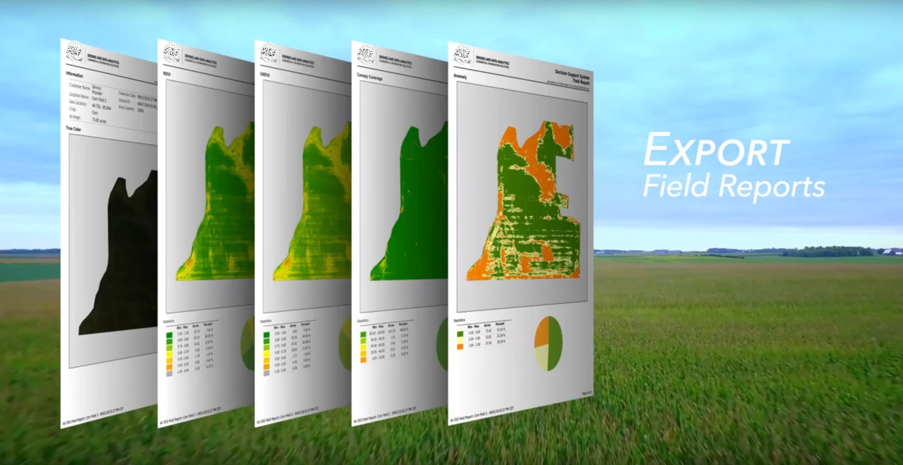
Drone imagery, combined with appropriate algorithms, provides a powerful tool for detecting crop stress, disease, and nutrient deficiencies. By analyzing the spectral characteristics of plants, anomalies indicative of these issues can be identified. Variations in color, texture, and vegetation indices (e.g., NDVI) provide valuable clues. For example, a noticeable decrease in the NDVI value in a specific area of a field can indicate stress or disease.
Detailed analysis of this data can then lead to timely interventions, minimizing yield loss and maximizing resource efficiency. By utilizing these methods, farmers can respond swiftly to these challenges, minimizing their impact on crop health.
Predicting Crop Yield and Optimizing Resource Management
Drone data, combined with historical data and predictive models, can significantly enhance crop yield prediction. By analyzing various factors, such as plant density, growth rate, and stress indicators, predictions can be made about the potential yield of a given field. Furthermore, data analysis can guide resource management strategies. For example, the identification of nutrient deficiencies can inform targeted fertilizer applications, optimizing resource use and reducing environmental impact.
Through this data-driven approach, agricultural practices can be refined, promoting sustainable and productive farming.
Data Processing Steps
| Step | Description |
|---|---|
| Raw Data Acquisition | Drone imagery, sensor data, and other relevant information are collected. |
| Image Preprocessing | Image enhancement, noise reduction, and geometric correction to improve image quality. |
| Georeferencing | Spatial referencing of the imagery to a geographic coordinate system. |
| Data Fusion | Integration of drone imagery with other datasets (e.g., soil sensors, weather data). |
| Image Analysis | Application of object detection, classification, and segmentation algorithms. |
| Crop Condition Assessment | Identification of crop stress, disease, and nutrient deficiencies. |
| Yield Prediction and Resource Optimization | Prediction of crop yield and optimization of resource management strategies. |
| Reporting and Visualization | Presentation of findings in a clear and understandable format for decision-making. |
Applications in Crop Management
Precision agriculture is rapidly evolving, and drone technology is at the forefront of this transformation. Drones are revolutionizing crop management, offering farmers unprecedented insights into their fields and enabling more efficient and targeted interventions. This detailed look explores how drones are used for precise crop monitoring, variable rate applications, optimizing planting, and assessing overall crop health.
Precise Crop Monitoring for Stress and Disease Identification
Drones equipped with multispectral and hyperspectral cameras provide detailed imagery of crops. These images capture subtle variations in the reflectance of light, revealing areas experiencing stress or disease before they become visually apparent. This early detection allows farmers to intervene promptly, minimizing crop loss and maximizing yields. For instance, a shift in the spectral signature of a crop can signal nutrient deficiencies, water stress, or the onset of disease.
Analyzing this data allows farmers to tailor interventions, such as targeted irrigation or fertilizer applications.
Variable Rate Application of Inputs
Drone imagery is pivotal in enabling variable rate application (VRA) of fertilizers, pesticides, and irrigation. By mapping the spatial variations in crop health and nutrient needs, drones allow for the precise application of inputs only where necessary. This significantly reduces waste and environmental impact. Farmers can tailor fertilizer application rates to specific areas, optimizing nutrient uptake and minimizing potential runoff.
Similarly, pesticide application can be targeted to areas with pest infestations, preventing unnecessary exposure of healthy plants. This technology significantly reduces the environmental footprint of agricultural practices.
In this topic, you find that technology is very useful.
Optimizing Planting Density and Crop Spacing
Drones, combined with geospatial analysis tools, enable optimized planting density and crop spacing. By analyzing field data, drones can pinpoint areas where plant density is too high or too low, leading to more efficient use of resources and improved yields. This allows farmers to tailor planting strategies to maximize the potential of their land. Precise mapping of crop rows and spacing also helps in efficient harvesting and minimizes potential yield losses.
Assessing Crop Health and Identifying Targeted Interventions
Drone-captured data, including multispectral imagery and vegetation indices, provide a comprehensive assessment of crop health. By analyzing these data, farmers can identify areas requiring targeted interventions. This data helps to determine the optimal time for fertilization, irrigation, or pest control. Furthermore, this information aids in the early detection of stress and disease, reducing the need for broad-spectrum treatments.
For example, drones can detect subtle changes in chlorophyll content, indicative of stress or disease, prompting targeted interventions before significant yield losses occur.
Drone-Based Crop Management Applications
| Application | Benefits | Limitations |
|---|---|---|
| Precise Crop Monitoring | Early detection of stress and disease, targeted interventions, reduced crop loss | High initial investment in drones and software, data analysis expertise required |
| Variable Rate Application | Reduced input costs, minimized environmental impact, optimized resource utilization | Requires accurate calibration and proper application equipment, data accuracy depends on the quality of drone imagery |
| Optimized Planting Density | Maximized yield potential, efficient resource use, improved land utilization | Requires detailed field mapping and careful planning, data analysis to determine optimal density |
| Targeted Interventions | Reduced environmental impact, cost-effective solutions, optimized resource use | Requires accurate interpretation of drone data, timely response to identified issues |
Applications in Livestock Management
Drones are rapidly transforming livestock management practices, offering unprecedented opportunities for improved animal health, pasture optimization, and overall farm efficiency. These unmanned aerial vehicles (UAVs) provide a unique aerial perspective, enabling comprehensive monitoring and data collection that was previously difficult and time-consuming. This allows for proactive interventions and optimized resource allocation.
Monitoring Livestock Health
Drone-based thermal imaging allows for early detection of sick or stressed animals. By capturing thermal signatures, drones can identify animals with unusual body temperatures, indicative of illness or discomfort. This early identification facilitates timely veterinary intervention, minimizing potential health issues and reducing economic losses. Additionally, drones can be equipped with hyperspectral cameras to analyze the condition of animal fur or skin, providing further insights into their overall health.
Location and Behavior Tracking
Real-time tracking of livestock using GPS-enabled drones offers a precise understanding of their movements and location. This technology is particularly useful for large-scale farms, aiding in herd management and preventing livestock from straying. The data gathered can also reveal behavioral patterns, which can be valuable in understanding the animals’ needs and adjusting management strategies accordingly. This data can be used to monitor breeding patterns and identify any potential problems.
Pasture Management and Livestock Density Analysis
Drone imagery provides valuable insights into pasture conditions. By capturing high-resolution aerial photographs, drones can assess the health and growth of vegetation, enabling farmers to identify areas with inadequate nutrition or overgrown areas. This information is crucial for effective pasture management, ensuring optimal forage availability and minimizing overgrazing. Furthermore, drone imagery allows for accurate livestock density analysis.
This analysis can be used to determine the optimal stocking rate for a particular pasture, maximizing productivity while preventing resource depletion. Areas with excessive density can be identified, allowing for appropriate adjustments in the herd size or the allocation of animals to different pastures.
Identifying Areas Needing Improved Pasture Management
Drone-captured data allows for the precise identification of areas needing improved pasture management. By analyzing vegetation health and density, drones can pinpoint specific areas where the pasture is failing to meet the nutritional needs of the livestock. This allows for targeted interventions such as fertilization, reseeding, or rotational grazing, maximizing the utilization of available resources and enhancing overall farm productivity.
These detailed assessments provide a roadmap for improving the overall quality and sustainability of the pastures.
Tracking Animal Movement and Behavior
Drones equipped with advanced sensors can track animal movement and behavior in real-time. This data can provide valuable insights into animal stress levels, feeding patterns, and social interactions. Monitoring movement patterns helps in identifying potential issues such as predator encounters or environmental stressors. Understanding these behaviors allows for the implementation of appropriate management strategies, ultimately improving animal welfare and productivity.
This allows for the early identification of potential problems in animal movement and behavior.
Table of Drone Applications in Livestock Management
| Application | Effectiveness in Different Scenarios |
|---|---|
| Thermal Imaging for Health Monitoring | High effectiveness in detecting early signs of illness in large herds, especially in remote areas. Useful for detecting stress and discomfort. |
| GPS Tracking for Location and Behavior | Highly effective for managing large herds, preventing livestock from straying, and monitoring breeding patterns. Also useful in tracking movements in complex terrain. |
| Pasture Management and Density Analysis | Excellent for identifying areas with nutritional deficiencies or overgrazing, allowing for precise adjustments in pasture management. Useful for optimizing forage allocation. |
| Identifying Areas for Improvement | Provides a detailed picture of areas requiring attention in pasture management. Enables targeted interventions, leading to improved pasture health and productivity. |
| Tracking Animal Movement and Behavior | Provides valuable insights into animal stress levels, feeding patterns, and social interactions. Allows for early identification of potential problems and the implementation of appropriate management strategies. Highly useful for identifying stress triggers. |
Environmental Impact Assessment
Precision agriculture, while boosting yields, necessitates careful consideration of its environmental footprint. Drone technology offers a powerful tool to assess and mitigate the impact of farming practices on soil, water, and vegetation, paving the way for more sustainable agricultural models. By providing detailed, real-time data, drones facilitate informed decision-making, leading to environmentally conscious farming strategies.
Drone-Based Soil Health Monitoring
Drone-mounted sensors can capture detailed images of soil characteristics, including texture, moisture content, and nutrient levels. This data is crucial for understanding soil health and identifying areas needing specific treatment. By mapping soil variability across a field, farmers can tailor fertilizer application, reducing waste and minimizing environmental impact. For example, a drone survey might reveal patches of depleted nitrogen in a field, prompting targeted fertilizer application instead of blanket application across the entire area.
Assessing Water Quality and Usage
Drones equipped with multispectral cameras can monitor water bodies surrounding farms, detecting algal blooms and other water quality issues. These observations can provide crucial data for managing irrigation practices and protecting water resources. Furthermore, drones can track water usage patterns, enabling farmers to optimize irrigation schedules and reduce water waste. Real-time monitoring of water levels in irrigation canals and reservoirs is possible with drone-based surveying.
Vegetation Cover Assessment and Remediation
Drone imagery allows for precise measurement of vegetation cover, providing valuable insights into plant health and potential environmental issues. By identifying areas with sparse or unhealthy vegetation, farmers can quickly address underlying problems such as nutrient deficiencies, pest infestations, or soil erosion. This data also aids in pinpointing areas that require environmental remediation, enabling targeted interventions. Drones can also assess the health of riparian vegetation, crucial for maintaining water quality and preventing erosion.
Drone Technology and Sustainable Agriculture
Drone-based environmental assessments empower farmers to make informed decisions about sustainable agricultural practices. The data collected enables them to optimize resource use, minimize environmental impact, and maximize crop yields while protecting natural resources. Farmers can implement precision farming techniques, such as variable rate application of fertilizers and pesticides, based on drone-derived insights.
Table of Environmental Parameters Assessable by Drone Technology
| Environmental Parameter | Drone Technology Application | Benefits |
|---|---|---|
| Soil Health (texture, moisture, nutrients) | Multispectral and hyperspectral imaging | Targeted fertilizer application, reduced waste, improved soil health |
| Water Quality (algae, turbidity) | Multispectral imaging over water bodies | Early detection of water pollution, improved water management |
| Vegetation Cover (health, density) | Multispectral and hyperspectral imaging | Identification of areas needing remediation, optimized pest and disease control |
| Erosion Assessment | High-resolution imagery and terrain mapping | Targeted soil conservation measures, reduced erosion |
| Irrigation Efficiency | Thermal imaging, vegetation indices | Optimized irrigation schedules, reduced water waste |
Future Trends and Challenges
The burgeoning field of drone technology in precision agriculture is poised for significant advancements, promising increased efficiency and profitability for farmers. However, navigating the regulatory landscape, ensuring data security, and maintaining cost-effectiveness remain crucial challenges. The integration of autonomous systems and artificial intelligence holds immense potential but also presents complex hurdles. This evolution necessitates a careful consideration of both the opportunities and obstacles.
Emerging Trends in Drone Technology
Drone technology is rapidly evolving, incorporating sophisticated advancements that enhance its capabilities in precision agriculture. Autonomous navigation systems, enabling drones to operate with minimal human intervention, are becoming increasingly sophisticated. These systems employ advanced sensors and algorithms to map fields, identify crop health issues, and perform tasks such as spraying pesticides precisely. Simultaneously, AI-powered image analysis is providing increasingly accurate and detailed insights into crop health and yields.
This sophisticated data processing can identify patterns and anomalies that would be difficult for human observation to detect, offering valuable predictive capabilities.
Challenges of Drone Deployment in Agriculture
Several significant challenges hinder the widespread adoption of drone technology in agriculture. Regulatory frameworks vary considerably across regions, creating a complex and sometimes inconsistent landscape for drone operators. Establishing clear guidelines for flight paths, airspace restrictions, and operational procedures is crucial for safe and efficient drone deployment. Data privacy concerns are also significant. The vast amounts of data collected by drones raise questions about the security and management of sensitive agricultural information.
Strict data protection measures are necessary to safeguard farmer information and ensure compliance with privacy regulations. Cost-effectiveness is another key factor. While drone technology offers substantial potential benefits, the initial investment in hardware, software, and training can be prohibitive for some farmers. Addressing the cost barriers is vital for widespread adoption.
Potential Future Applications of Drone Technology
Drone technology’s applications in precision agriculture are expanding beyond current practices. Future applications include predictive modeling of crop yields based on real-time data collected by drones. Drones equipped with sophisticated sensors can provide detailed insights into soil conditions, nutrient levels, and water requirements. This real-time data can enable farmers to optimize irrigation and fertilization strategies, leading to increased crop yields and reduced resource consumption.
Furthermore, drones can monitor livestock health and behavior, providing valuable data for disease prevention and herd management. This allows for early identification of potential issues, facilitating timely intervention and preventing widespread health problems.
Ongoing Research and Development Efforts
Extensive research and development efforts are underway to refine drone technology for precision agriculture. Researchers are working to enhance the accuracy and speed of image processing algorithms used to analyze drone data. This includes developing advanced image recognition models capable of distinguishing subtle variations in crop health and detecting early signs of disease or stress. Simultaneously, there’s a focus on developing more robust and reliable autonomous navigation systems to handle diverse agricultural terrains and challenging weather conditions.
Future Directions of Drone Technology in Agriculture
| Future Direction | Impact on Agricultural Practices |
|---|---|
| Autonomous Navigation and AI-Powered Analysis | Increased efficiency in data collection, reduced human labor, and improved decision-making through data-driven insights. |
| Improved Data Management and Processing | Enhanced precision in crop management, optimized resource utilization, and improved yield prediction. |
| Integration with IoT and other technologies | Real-time monitoring of crops and livestock, improved connectivity, and data-driven insights into farm operations. |
| Cost Reduction and Accessibility | Wider adoption by smaller farms and increased competitiveness in the agricultural sector. |
| Addressing Regulatory and Privacy Concerns | Establishment of clear regulations, development of secure data management protocols, and ethical considerations for the use of drone technology. |
Final Conclusion

In conclusion, drone technology presents a significant advancement in precision agriculture, offering a range of benefits from enhanced crop monitoring to optimized resource management. While challenges like cost and regulatory hurdles remain, the potential for increased yields, sustainability, and reduced environmental impact is undeniable. Further research and development are crucial to unlock the full potential of this technology, paving the way for a more efficient and environmentally responsible agricultural future.