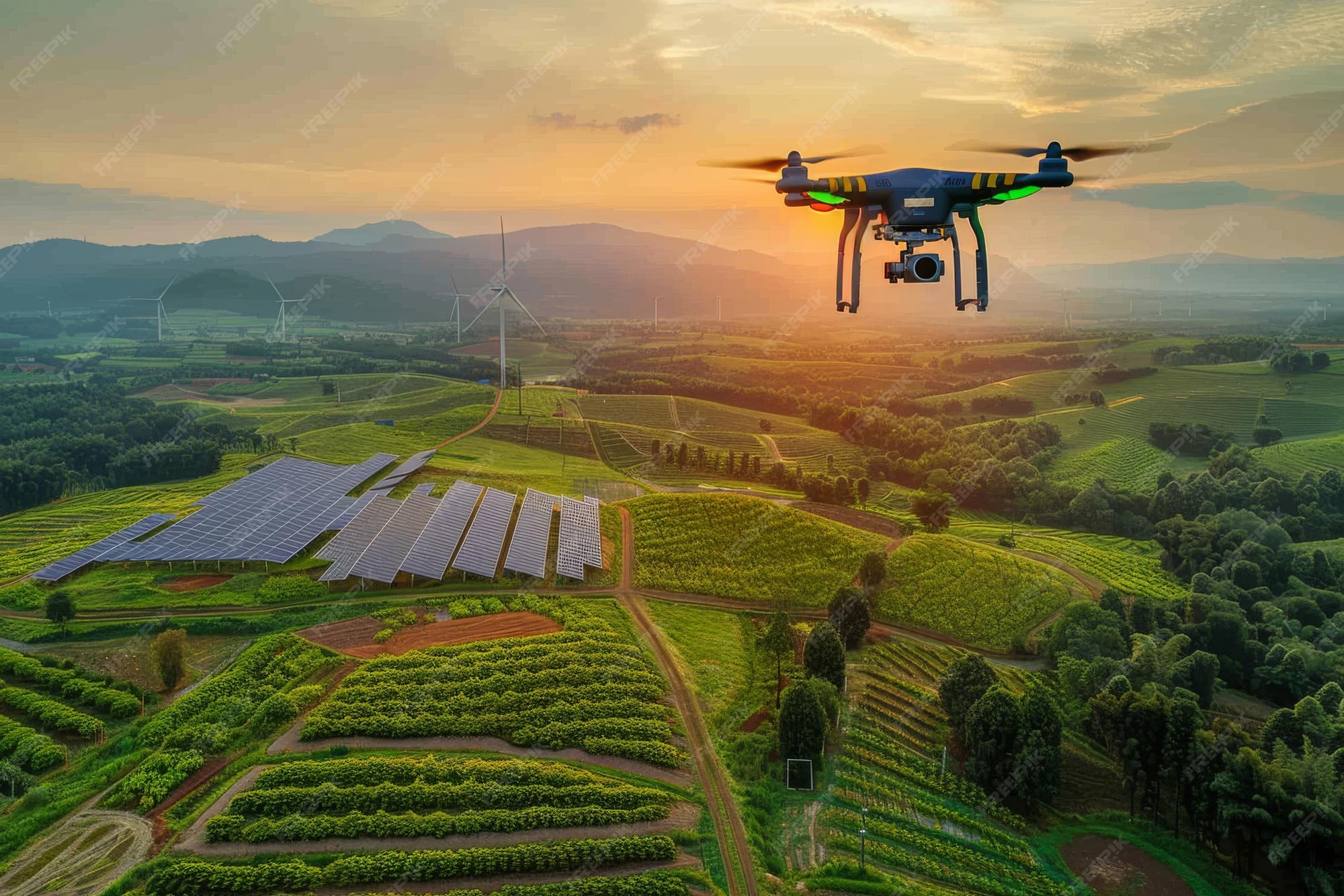
Drones are revolutionizing agricultural practices, offering a precision approach to sustainable farming. These unmanned aerial vehicles, equipped with advanced sensors, are providing farmers with unprecedented insights into their fields, enabling data-driven decisions for optimal resource management and improved crop yields. From monitoring crop health to optimizing irrigation, drone technology is poised to transform the future of agriculture, while minimizing environmental impact.
This analysis delves into the diverse applications of drone technology in sustainable farming, from the initial deployment and data collection to the crucial analysis and decision-making processes. It also examines the environmental benefits and potential challenges, providing a comprehensive overview of this rapidly evolving sector.
Introduction to Drone Technology in Agriculture
Drone technology is rapidly transforming agricultural practices, offering unprecedented precision and efficiency in monitoring and managing crops and livestock. These unmanned aerial vehicles (UAVs), commonly known as drones, equipped with advanced sensors and imaging systems, collect detailed data about fields, enabling farmers to make data-driven decisions for optimal yield and resource utilization. The data collected can lead to significant improvements in water management, fertilization, pest control, and overall farm productivity.
Drone Types for Agricultural Use
Various types of drones cater to different agricultural needs. Lightweight, compact drones are ideal for surveying small plots and orchards, while larger, more robust models can handle extensive acreage and complex terrains. Specialized drones designed for specific tasks, such as spraying pesticides or collecting high-resolution imagery, are also available. The choice of drone type depends on factors like the size of the farm, the type of crops grown, and the specific agricultural tasks to be performed.
Sensors and Imaging Systems
Drones are equipped with a variety of sensors and imaging systems to capture crucial data. Multispectral and hyperspectral cameras capture data across a wider range of electromagnetic wavelengths, allowing for detailed analysis of crop health, identifying stress indicators and nutrient deficiencies. Thermal cameras measure the temperature of plants, helping detect heat stress or disease outbreaks. LiDAR (Light Detection and Ranging) systems measure the height and density of vegetation, which aids in assessing crop growth and identifying areas needing attention.
These various systems provide a holistic view of the farm environment.
Data Types Collected by Drones
Agricultural drones gather diverse data types. High-resolution imagery provides visual insights into crop health, identifying areas with stress or disease. Data on plant height, canopy cover, and vegetation indices (NDVI) quantify the overall health and vigor of crops. Thermal imagery pinpoints areas of high or low temperature, which can signal problems such as heat stress or disease infestations.
Drone-collected data also includes spatial data, enabling precise mapping of field conditions and crop distribution. The integration of these diverse data points creates a comprehensive understanding of the farm.
Improving Agricultural Practices with Drone Data
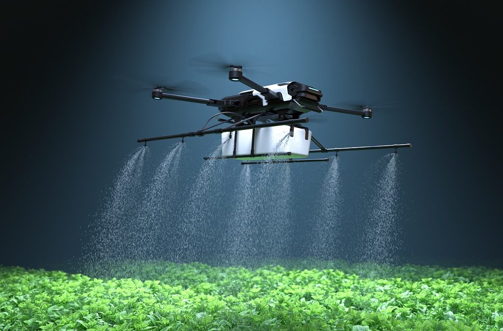
Drone-acquired data enables farmers to make informed decisions, optimizing their practices. Detailed maps of crop health allow for targeted applications of water, fertilizers, and pesticides, minimizing waste and maximizing efficiency. Identifying areas with nutrient deficiencies enables precise fertilizer application, improving yield and reducing environmental impact. Drones also aid in precision spraying, ensuring targeted pest control and reducing the environmental impact of broad-spectrum treatments.
By analyzing drone data, farmers can improve their resource management and increase yields.
Sustainable Farming Practices Enhanced by Drones

Drone technology is rapidly transforming agricultural practices, offering innovative solutions for resource management, precision agriculture, and crop monitoring. This precision approach is proving crucial in achieving sustainable farming goals, minimizing environmental impact, and maximizing yields. Farmers are increasingly embracing these technologies to adapt to changing conditions and enhance their overall operational efficiency.
Resource Management Optimization
Drones provide unprecedented insights into resource allocation, enabling more targeted and efficient use of water, fertilizers, and pesticides. Traditional methods often lead to over-application, resulting in environmental contamination and economic waste. Drone-based systems, equipped with multispectral sensors, can precisely map areas of crop stress or nutrient deficiencies. This allows for targeted application of resources, minimizing waste and maximizing their impact.
For instance, a drone can identify areas of a field requiring irrigation, enabling localized water delivery instead of blanket irrigation, thereby conserving water resources and reducing the overall environmental footprint. Similarly, precise fertilizer application can be achieved based on real-time crop needs, reducing fertilizer use by up to 30% in some cases, a significant step towards sustainability.
Precision Agriculture Techniques
Drone technology is instrumental in implementing precision agriculture techniques. These techniques involve tailoring agricultural practices to specific needs of different areas within a field. Drones equipped with high-resolution cameras and sensors can create detailed maps of crop health, soil conditions, and other relevant parameters. This detailed information allows farmers to make data-driven decisions about planting, fertilization, and pest control, maximizing yields and minimizing environmental impact.
This data-driven approach allows for personalized management of different sections of a field, leading to improved resource utilization and higher yields.
Crop Health Monitoring and Issue Identification
Drones equipped with advanced sensors, such as multispectral cameras, can monitor crop health and identify potential issues early on. This early detection is crucial for effective management and mitigation of problems, preventing significant yield losses. By capturing high-resolution images, drones can detect subtle changes in vegetation indicative of stress, disease, or nutrient deficiencies. These early warning systems are significantly more effective than traditional methods, such as visual inspections, which often miss subtle issues until they become more prominent.
Prompt identification allows farmers to take corrective actions, such as targeted pesticide application or nutrient adjustments, preventing further damage and maximizing yield.
Comparison with Traditional Methods
Drone-based solutions offer significant advantages over traditional methods in terms of efficiency and cost. Traditional methods, such as manual inspections or ground-based sensors, are often time-consuming and labor-intensive. Drones, on the other hand, can cover vast areas quickly and efficiently, providing comprehensive data in a fraction of the time. This efficiency translates to significant cost savings for farmers, as it reduces labor costs and allows for more rapid responses to emerging issues.
In addition to efficiency, drone-based systems offer increased accuracy and precision in data collection, leading to more effective and targeted interventions.
Environmental Benefits
The use of drone technology in sustainable farming practices has significant environmental benefits. By enabling precise application of resources, drone technology minimizes waste, reducing environmental contamination from excess fertilizer or pesticide use. The efficient use of water resources through targeted irrigation also contributes to conservation efforts. Drone-based monitoring facilitates early detection of crop issues, preventing the spread of diseases and minimizing the use of chemical interventions.
Reduced pesticide use, in turn, protects biodiversity and improves water quality, contributing to a healthier ecosystem. This data-driven approach not only enhances yields but also safeguards the environment.
Data Analysis and Decision Making with Drone Data
Drone technology is rapidly transforming agricultural practices, offering unprecedented insights into crop health, resource utilization, and yield potential. By analyzing the vast datasets generated by drones, farmers and agricultural professionals can make more informed decisions, optimize resource allocation, and enhance overall farm productivity. This data-driven approach promises to be critical in ensuring sustainable farming practices for a growing global population.
Analyzing Crop Health Patterns from Drone Data
Drone-mounted multispectral cameras capture detailed images of crops, revealing subtle variations in their health. Analyzing these images, using specialized software, allows for the identification of stress indicators such as nutrient deficiencies, pest infestations, or water stress. This detailed analysis, previously only possible through extensive fieldwork, is now accessible in a fraction of the time and with significantly greater coverage.
For example, a farm using drone imagery might observe a yellowing of certain crop sections, triggering targeted interventions to address potential nutrient imbalances or water issues before they severely impact yield.
Determining Irrigation Needs Using Drone Data
Drone imagery provides precise data on soil moisture levels, enabling targeted irrigation. By analyzing the spectral signatures of different areas within a field, software can identify areas with varying moisture content. This information is invaluable for optimizing irrigation schedules and minimizing water waste. Farmers can implement precision irrigation, delivering water only to the areas that need it, saving both water and money.
A recent case study in California demonstrated that using drone-based soil moisture mapping reduced water consumption by 20% while maintaining yield levels.
Structuring Drone Data for Easy Interpretation
The volume of data generated by drones requires a structured format for effective interpretation. Data from different sensors, such as RGB cameras and multispectral sensors, needs to be integrated and organized in a cohesive database. This structured format allows for seamless data sharing among farm managers, researchers, and other stakeholders. Using a cloud-based platform, for example, allows for centralized data storage and access, enabling efficient analysis and reporting.
Mapping and Assessing Crop Yields with Drone Imagery
Drone-captured imagery allows for precise mapping of crop yields. By overlaying the imagery with field boundaries and crop type information, software can estimate yield distribution across the entire field. This analysis allows farmers to identify areas with lower yields, enabling targeted interventions to optimize production in those specific locations. A farm using this technique may notice that one section of a field has lower yield compared to the rest, prompting the farmer to investigate the cause, such as nutrient deficiencies or disease, and implement targeted treatments to increase yield in that particular area.
When investigating detailed guidance, check out technology now.
Developing a Decision Support System for Farm Managers
A comprehensive decision support system (DSS) leverages drone data to provide farm managers with actionable insights. This system can integrate various data sources, including weather forecasts, soil conditions, and historical yield data, with drone-collected imagery. The system can then provide recommendations for optimal planting times, irrigation strategies, and pest management, based on real-time insights from drone data. For instance, the DSS might predict a potential drought based on current soil moisture levels and drone data, alerting the farm manager to adjust irrigation schedules proactively.
Drone Technology Solutions for Specific Crops
Drone technology is rapidly transforming agricultural practices, offering precision and efficiency in monitoring and managing crops. This precision allows for targeted interventions, optimizing resource use and minimizing environmental impact. The ability to assess crop health, identify areas needing attention, and precisely apply treatments makes drone technology a valuable tool for sustainable farming across various crop types.
Fruit Trees
Fruit tree orchards benefit significantly from drone-based monitoring. Regular aerial surveys provide a comprehensive view of the entire orchard, enabling early detection of diseases, pests, and stress factors. This proactive approach allows for timely interventions, preventing widespread damage and maximizing yields. Drones equipped with multispectral cameras can assess the health of individual trees, identifying areas with nutrient deficiencies or water stress.
This targeted approach reduces the need for broad-spectrum treatments, preserving the environment and enhancing fruit quality. For instance, in California’s almond orchards, drones are used to identify areas needing irrigation adjustments, leading to water conservation and improved crop health.
Vegetables
Drone technology offers valuable insights for optimizing vegetable production. Regular assessments of plant health, nutrient levels, and pest infestations allow for timely interventions, maximizing yield and quality. Multispectral imagery from drones can identify areas of stress, enabling targeted applications of fertilizers or pesticides, reducing environmental impact and enhancing crop quality. This technology is particularly useful in large-scale vegetable farms where traditional methods of assessment are time-consuming and less efficient.
In greenhouses, drones can track the growth and development of plants, enabling optimized environmental control, maximizing productivity, and reducing resource waste.
Grains
Drone technology is crucial for maximizing yields and minimizing losses in grain production. Aerial surveys can identify areas with varying levels of nutrient availability or water stress, enabling targeted applications of fertilizers and irrigation. Early detection of diseases and pests is essential for minimizing crop damage and losses. Drones can monitor crop health throughout the growing season, providing insights into plant vigor and stress indicators.
For example, in wheat fields, drones are used to map out areas with varying soil conditions, allowing for precise fertilizer application and improved yield.
Adapting to Specific Crop Needs
The adaptability of drone technology is a key factor in its success. Different crops have unique requirements, and drone systems can be tailored to meet these needs. The sensors used in drones can be adjusted to capture specific data relevant to the crop type, and the processing algorithms can be modified to interpret the data in a way that is most beneficial for that particular crop.
For instance, in vineyards, drones equipped with specialized sensors can detect early signs of fungal diseases, enabling timely interventions and preserving the quality of the grapes. In areas with challenging terrain, drones equipped with advanced navigation systems can access difficult-to-reach areas, ensuring comprehensive monitoring and treatment.
Challenges and Considerations of Drone Use in Agriculture
Drone technology is rapidly transforming agricultural practices, offering unprecedented opportunities for precision farming. However, widespread adoption faces significant challenges that must be addressed for optimal implementation and societal benefit. These challenges encompass technological limitations, regulatory hurdles, operational safety concerns, and the economic implications of adopting this innovative approach. A comprehensive understanding of these aspects is crucial for realizing the full potential of drone-based agriculture.
Technological Limitations
Drone technology, while advanced, still faces limitations in certain agricultural applications. Weather conditions, such as strong winds or heavy rain, can disrupt drone operations, potentially leading to data loss or damage to the equipment. The limited flight time of current drones necessitates multiple flights for extensive coverage, adding to operational costs and time constraints. Furthermore, terrain complexity, including dense vegetation or uneven landscapes, can impact the drone’s ability to navigate and collect accurate data.
Precise positioning and obstacle avoidance algorithms are still being refined, requiring ongoing technological advancements to overcome these challenges.
Legal and Regulatory Frameworks
Navigating the legal and regulatory landscape surrounding drone usage in agriculture is crucial for responsible and compliant operations. Different countries have varying regulations regarding drone operation, airspace restrictions, and data privacy. Compliance with these regulations is essential to avoid penalties and ensure legal operation. Agricultural drone pilots need to be properly trained and certified to ensure safe and efficient operation.
Specific regulations concerning data ownership and usage rights must be established to prevent conflicts and protect the interests of all parties involved. For instance, in many jurisdictions, drones operating in agricultural areas must comply with flight restrictions in populated areas or near airports.
Maintenance and Safety Procedures
Maintaining and ensuring the safety of drone operations is paramount to maximizing efficiency and preventing incidents. Regular maintenance checks are essential to ensure the drone’s optimal performance and prolong its lifespan. This includes inspections of critical components such as the battery, propellers, and sensors. Proper storage and handling procedures are also critical to prevent damage and ensure the longevity of the equipment.
Safety protocols, including pre-flight checks and emergency procedures, should be meticulously followed to minimize the risk of accidents. Training programs for drone operators and maintenance personnel should emphasize safety awareness and best practices.
Potential Risks Associated with Drone Usage
Potential risks associated with drone use in agriculture encompass several areas. Data security breaches, especially if sensitive data is collected and stored, are a major concern. Privacy issues related to the collection and use of agricultural data must be carefully addressed. Malfunctioning drones or equipment failure can result in crop damage, which may be significant. Unintended consequences of drone application, such as inaccurate pesticide application, can also pose environmental risks.
Strict adherence to safety guidelines and protocols, combined with rigorous data security measures, is essential to mitigate these risks.
Costs and Benefits of Adopting Drone Technology
| Feature | Cost | Benefit |
|---|---|---|
| Initial Investment | High | Increased Efficiency |
| Operational Costs | Moderate | Reduced Input Costs |
| Data Analysis | Moderate | Improved Decision Making |
| Maintenance | Low | Reduced Labour Costs |
| Safety | High | Enhanced Safety |
The initial investment in drone technology can be substantial, encompassing the cost of the drone itself, necessary software, and supporting infrastructure. However, the long-term benefits, such as increased efficiency and reduced labor costs, often outweigh the initial expenditure. Data analysis can yield significant improvements in decision-making, leading to optimized resource allocation and enhanced yield.
Future Trends and Innovations in Drone Technology for Farming
The agricultural sector is rapidly adopting drone technology, driven by the need for increased efficiency, precision, and sustainability. This shift marks a pivotal moment in the evolution of farming practices, promising to revolutionize how crops are monitored, managed, and harvested. Future developments in drone technology will be crucial in meeting the growing global food demand while minimizing environmental impact.
Autonomous Navigation and Flight Systems
Advancements in autonomous navigation systems will enable drones to perform complex tasks with greater precision and efficiency. This includes features like improved obstacle avoidance, dynamic flight path adjustments, and more sophisticated landing mechanisms. These advancements will reduce the need for human intervention during data collection and application tasks, potentially leading to lower operational costs and increased productivity. Real-world examples include autonomous crop spraying systems already being tested in various regions, showcasing the potential for increased precision and reduced chemical usage.
Enhanced Sensor Technology and Data Acquisition
The future of drone-based agriculture relies heavily on advancements in sensor technology. High-resolution multispectral and hyperspectral cameras will provide detailed information on crop health, identifying stress factors and nutrient deficiencies at early stages. Thermal imaging will allow for the detection of heat stress in plants, while lidar (light detection and ranging) technology will enable 3D mapping of fields and precise object identification.
This increased data accuracy will allow for more targeted and effective interventions, ultimately leading to improved crop yields and resource optimization.
Integration with Internet of Things (IoT) and Artificial Intelligence (AI)
The integration of drone technology with IoT and AI will create a comprehensive data ecosystem for agricultural decision-making. IoT devices deployed on the ground can collect data on soil conditions, weather patterns, and other environmental factors. This data, combined with drone-collected imagery, can be processed by AI algorithms to predict crop yields, optimize irrigation schedules, and identify potential pest outbreaks.
The ability to predict these factors with greater accuracy will allow farmers to react proactively to challenges and enhance overall efficiency.
Drone-Based Application Systems
Future drone systems will be equipped with more sophisticated application capabilities beyond simple spraying. This includes targeted fertilization, precise seeding, and even the delivery of specific nutrients or growth hormones directly to individual plants. These advanced capabilities will enable personalized crop care, leading to improved yields and reduced waste. Specific examples include the development of drones equipped with specialized dispensing systems for targeted pesticide application, minimizing environmental impact.
Long-Term Impact on the Agricultural Industry
The integration of drone technology into farming practices will have a significant long-term impact on the agricultural industry. Improved precision agriculture will increase crop yields and reduce the environmental footprint of farming. Increased efficiency will lead to lower operational costs, making agriculture more accessible and profitable. This trend is already observed in countries with large-scale adoption of drone technology for agriculture, demonstrating significant potential for productivity gains.
Furthermore, the data-driven insights generated by drone technology will empower farmers to make more informed decisions, fostering a more sustainable and resilient agricultural system.
Case Studies of Successful Drone Implementation in Farms
Drone technology is rapidly transforming agricultural practices, offering precision and efficiency previously unattainable. Numerous farms are successfully adopting drones, demonstrating the tangible benefits of this technology. These case studies reveal the diverse applications of drones in various farming scenarios, highlighting their positive impact on yield, cost reduction, and overall farm management.
Successful Drone Implementation in Different Farming Scenarios
Drone technology’s versatility extends across a wide range of farming practices. From large-scale commercial operations to smaller family farms, drones are proving effective tools for crop monitoring, pest detection, and field management. These applications, combined with the analysis of drone-acquired data, are revolutionizing how farms operate, providing insights and actionable information.
Examples of Farms That Have Adopted Drone Technology
Several farms across the globe have successfully integrated drone technology into their operations. A notable example is the “Green Valley Farms” in California, a large-scale agricultural enterprise that utilizes drones for crop health assessment. Another successful implementation is “River Valley Farm,” a smaller operation in the Midwest, employing drones for targeted pesticide application. These farms are just a few examples of how drones are becoming an essential part of modern farming.
Positive Outcomes Achieved by These Farms
The adoption of drone technology has yielded significant benefits for these farms. Green Valley Farms, for example, reported a 15% increase in yield due to the early detection of crop stress via drone imagery. This allowed for timely intervention, optimizing irrigation and nutrient management. River Valley Farm experienced a 20% reduction in pesticide usage by precisely targeting areas with pest infestations, resulting in cost savings and a more environmentally friendly approach.
Key Takeaways from These Case Studies
The case studies highlight several key takeaways for other farms considering drone implementation. These include the importance of accurate data analysis to inform decisions, the need for skilled operators to effectively utilize drone technology, and the potential for substantial cost savings and increased yields. Furthermore, effective communication between drone operators and farm managers is critical for maximizing the benefits of this technology.
Challenges Overcome by Farms Using Drone Technology
Implementing drone technology in agriculture isn’t without its challenges. One significant hurdle is the initial investment required for purchasing drones and related equipment. Another challenge lies in the need for specialized training to operate and analyze the drone data effectively. Green Valley Farms, for example, addressed these challenges through a phased approach to drone integration, focusing on training and support.
Data Analysis and Decision Making with Drone Data
Drone-captured data provides valuable insights for informed decision-making. By analyzing images and data collected by drones, farmers can identify areas of stress in crops, pinpoint pest infestations, and optimize resource allocation. This data-driven approach helps farmers to make more precise decisions, leading to improved efficiency and sustainability.
Final Summary
Drone technology solutions for sustainable farming practices are demonstrating significant potential for improving efficiency and reducing environmental impact. While initial investment costs can be substantial, the long-term benefits, including reduced resource consumption and increased yields, suggest a strong case for adoption. The integration of drone technology with other emerging technologies like AI and IoT holds immense promise for future innovations and applications in the agricultural sector.