The increasing use of drones in agriculture presents both opportunities and challenges for the environment. This comprehensive assessment examines the potential environmental impacts of drone operations, from noise pollution and wildlife disturbance to effects on air, water, soil, and vegetation. Understanding these impacts is crucial for developing responsible drone use practices and ensuring sustainable agricultural practices.
This study meticulously analyzes the environmental footprint of various drone models, battery types, and agricultural applications. Detailed tables provide comparisons of traditional methods with drone-based approaches, highlighting potential benefits and drawbacks of this emerging technology. Furthermore, the assessment explores data collection and analysis methods, providing a framework for measuring and mitigating environmental damage.
Introduction to Drone Agriculture
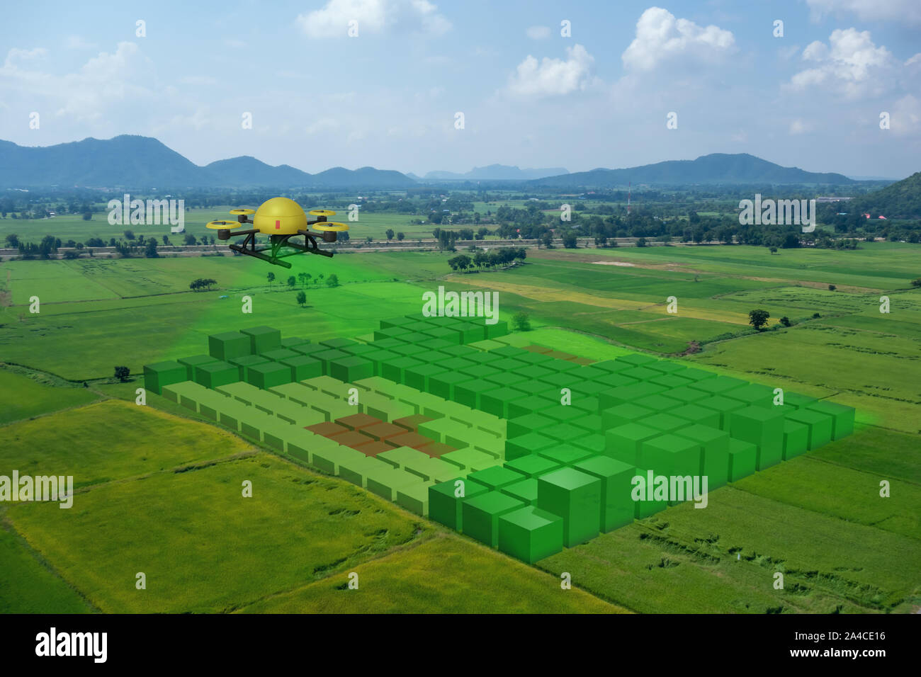
Drone technology is rapidly transforming agricultural practices, offering precision and efficiency gains previously unimaginable. From crop monitoring and spraying to soil analysis and livestock tracking, drones are proving invaluable tools for optimizing farm operations and increasing yields. This shift towards drone-based agriculture is driven by the need for sustainable and data-driven approaches to farming in the face of growing global food demands.The increasing adoption of drone technology in agriculture is largely due to its ability to collect detailed data quickly and cost-effectively, which is crucial for informed decision-making in crop management.
Drone Types in Agricultural Settings
Different types of drones cater to specific agricultural needs. Lightweight, small drones, often equipped with high-resolution cameras, are suitable for aerial surveys and quick assessments of large areas. Larger, more robust drones are better suited for tasks requiring more payload, such as carrying spraying equipment or specialized sensors. The choice of drone type depends on the scale of the operation, the specific tasks to be performed, and the size of the agricultural field.
Sensors and Technologies in Agricultural Drones
Agricultural drones are increasingly equipped with a variety of advanced sensors and technologies. High-resolution cameras provide detailed visual imagery for crop health assessments and identification of problem areas. Multispectral and hyperspectral sensors detect subtle variations in plant health that might be missed by the naked eye, enabling early disease detection and targeted interventions. Thermal imaging sensors help identify areas with temperature anomalies, indicating potential stress or disease issues.
LiDAR (Light Detection and Ranging) technology, while not as prevalent, measures the distance to objects, which can be valuable for creating highly detailed 3D maps of the field. GPS systems ensure precise location data for accurate mapping and targeted application of inputs.
Workflow of a Drone-Based Agricultural Operation
A typical drone-based agricultural operation follows a well-defined workflow. First, a flight plan is meticulously designed, considering the terrain, weather conditions, and the specific tasks to be performed. The drone is then launched and equipped with the appropriate sensors and payloads. During the flight, the drone captures high-resolution imagery and data. Once the flight is completed, the data is processed using specialized software.
This data analysis provides insights into crop health, nutrient deficiencies, and pest infestations, which can then be used to inform decisions on fertilizer application, irrigation scheduling, and pest control strategies. Finally, these insights can be integrated into farm management systems to optimize resource use and yield.
Environmental Impact Assessment Framework Components
| Component | Description |
|---|---|
| Pre-Flight Assessment | Evaluating existing environmental conditions, including soil types, water sources, and nearby habitats. This stage also considers potential noise pollution and air quality impacts from drone operations. |
| Flight Operations Monitoring | Implementing strict flight protocols and adhering to established guidelines to minimize disturbance to wildlife, vegetation, and water bodies. This includes careful consideration of wind conditions and other factors that may affect flight safety and environmental impact. |
| Data Analysis and Interpretation | Assessing the collected data for environmental impacts, including soil erosion, water contamination, and changes in biodiversity. This phase also analyzes the efficiency of drone-based practices compared to traditional methods. |
| Mitigation Strategies | Developing and implementing strategies to minimize potential environmental damage, such as adjusting flight paths to avoid sensitive areas, using less impactful pesticides, and implementing proper waste disposal protocols for drone components. |
| Post-Flight Evaluation | Monitoring the long-term environmental effects of drone use, such as changes in soil health, water quality, and biodiversity levels. This phase also assesses the economic viability of drone agriculture versus traditional methods, factoring in the cost of drone operation, maintenance, and data analysis. |
Environmental Impacts of Drone Operations
The burgeoning use of drones in agriculture presents a double-edged sword. While offering precision and efficiency, these aerial vehicles introduce potential environmental concerns that must be carefully considered. The increasing reliance on drones for tasks like crop monitoring and spraying necessitates an assessment of their ecological footprint, especially regarding noise pollution, wildlife interactions, and soil and biodiversity impacts. A comprehensive understanding of these impacts is critical for responsible drone deployment and sustainable agricultural practices.
Noise Pollution
Drone operations generate noise, a potential disturbance factor for both human and animal populations. The sound levels emitted by agricultural drones vary depending on the type of drone, its engine, and flight conditions. Studies have shown that prolonged exposure to elevated noise levels can negatively affect wildlife behavior, potentially disrupting feeding patterns, migration routes, and nesting activities. Furthermore, noise pollution from drone operations can affect the well-being of nearby communities, potentially leading to complaints and restrictions on drone usage.
Impacts on Wildlife
Drones pose a threat to wildlife, particularly through collisions and disturbance. As drones navigate agricultural landscapes, they may encounter birds, insects, and other animals, potentially leading to collisions with fatal consequences. The presence of drones can also disturb wildlife, causing stress, altering natural behaviors, and potentially disrupting sensitive ecological balances. This impact is especially significant in protected areas or habitats with vulnerable species.
For instance, the increased presence of drones near migratory bird routes could potentially alter their flight patterns.
Effects on Soil Quality and Biodiversity
The use of drones for spraying pesticides and fertilizers, while offering precision, can potentially affect soil quality and biodiversity. Inappropriate application methods, using drones for spraying pesticides or fertilizers in the wrong quantities, or using the wrong type of pesticide, can cause soil degradation, harming beneficial soil organisms and impacting the delicate balance of the ecosystem. Furthermore, the use of certain pesticides can harm beneficial insects and pollinator populations, which play a crucial role in maintaining biodiversity and agricultural productivity.
Explore the different advantages of drone technology for early disease detection in crops that can change the way you view this issue.
This underscores the need for careful consideration of drone-assisted application methods and the selection of environmentally friendly products.
Drone Battery Types and Environmental Impact
The environmental impact of drone operations extends to the life cycle of drone batteries. Different battery types have varying environmental footprints, ranging from lithium-ion to nickel-metal hydride batteries. The extraction of raw materials, manufacturing processes, and eventual disposal of batteries all contribute to their overall environmental impact. Understanding the lifecycle impacts of different battery types is critical for minimizing the environmental consequences of drone adoption.
Comparison of Drone Battery Options and Environmental Footprints
| Battery Type | Material Composition | Manufacturing Impact | Disposal Challenges | Environmental Footprint |
|---|---|---|---|---|
| Lithium-ion | Lithium, cobalt, nickel, manganese | High energy consumption, potential for toxic emissions | Difficult recycling, potential for fire hazard | Medium to high |
| Nickel-metal hydride | Nickel, metal hydrides | Lower energy consumption compared to Li-ion | Easier recycling | Medium |
| Lead-acid | Lead, sulfuric acid | High lead content, significant environmental concerns | Hazardous waste disposal | High |
Note: Environmental footprints are relative and can vary based on specific manufacturing processes, recycling rates, and end-of-life management.
Impact on Air Quality
Agricultural drone use, while promising for efficiency, introduces potential air quality concerns. The engines and battery charging processes of these drones can release pollutants into the atmosphere, impacting the surrounding environment and potentially human health. Understanding these effects and implementing mitigation strategies are crucial for responsible drone integration into agricultural practices.The growing adoption of drones in agriculture necessitates a thorough assessment of their environmental footprint, particularly regarding air quality.
Emissions from drone engines and battery charging processes, along with the overall operational patterns, contribute to the complex picture of potential air quality impacts in agricultural areas. This analysis examines the specific pollutants involved, their potential health effects, and the need for comprehensive monitoring strategies.
Potential Air Pollutants
Drone engines, particularly those powered by gasoline or diesel, emit various pollutants, including particulate matter (PM), nitrogen oxides (NOx), and volatile organic compounds (VOCs). Battery charging processes, while generally cleaner, can also release emissions, depending on the battery technology. For example, lithium-ion batteries, common in drone applications, can release harmful byproducts during charging and discharging, including heavy metals, depending on the manufacturing process.
Effects on Air Quality in Agricultural Areas
Drone operations, especially concentrated in specific agricultural zones, can contribute to localized air pollution. The density of drone flights and the proximity to populated areas are crucial factors in determining the extent of these impacts. Increased particulate matter can reduce air visibility and potentially exacerbate respiratory problems in nearby communities. Nitrogen oxides can contribute to smog formation and acid rain, affecting plant life and potentially harming human health.
Understanding these localized impacts is crucial for developing effective mitigation strategies.
Long-Term Impacts of Drone Use
The long-term impacts of drone use on air quality remain an area of ongoing research. Projections suggest that the continued growth of drone operations could potentially lead to increased air pollution in agricultural regions, especially if emission standards are not met or if appropriate monitoring and mitigation strategies are not implemented. Long-term studies are needed to quantify the cumulative effect of drone operations on air quality over time.
For example, if drone use becomes more widespread in agricultural settings without implementing emission control measures, the cumulative impact on air quality could be substantial.
Monitoring Air Quality Around Drone Operation Zones
Effective monitoring is essential to quantify and mitigate the environmental impact of drone operations. A comprehensive monitoring program should include the following elements:
- Establishing baseline air quality data before drone operations begin in a specific area. This baseline will provide a benchmark against which future changes can be measured.
- Implementing continuous air quality monitoring stations in and around drone operation zones. Real-time data collection will help track air quality changes during drone flights and charging activities.
- Using portable air quality sensors to measure air quality at different points during drone operations. These measurements will provide more detailed insights into the specific areas and times of highest pollution levels.
- Collecting data on drone operation patterns, such as flight frequency, duration, and altitude. Correlation analysis between drone activities and air quality readings can highlight specific operational practices that have a significant impact on air quality.
Methods for Measuring Air Quality
Different methods are used to measure air quality, each with specific strengths and weaknesses.
| Method | Description | Strengths | Weaknesses |
|---|---|---|---|
| Particulate Matter (PM) Monitoring | Measurements of suspended particulate matter in the air using instruments like optical particle counters or gravimetric samplers. | Provides direct quantification of PM levels. | Can be expensive and require specialized equipment. |
| Gas Monitoring (NOx, VOCs) | Measurements of gaseous pollutants like nitrogen oxides and volatile organic compounds using gas chromatographs or electrochemical sensors. | Identifies specific gas pollutants and their concentrations. | May require specialized training and calibration for accurate measurements. |
| Continuous Monitoring Stations | Fixed monitoring stations equipped with multiple sensors to provide continuous air quality data. | Provides a comprehensive overview of air quality in the region. | May be costly to establish and maintain a network of stations. |
Impact on Water Resources
Drone agriculture, while promising increased efficiency, raises concerns about its impact on water resources. The delicate balance between agricultural production and water conservation is crucial, and understanding the potential effects of drone operations is essential for sustainable practices. From water usage during operations to the potential for pollution from maintenance, a comprehensive assessment is needed to evaluate the long-term implications.
Water Usage During Drone Operations
Drone operations, particularly those involving spraying, require water for battery charging and cooling systems. The amount of water consumed varies depending on the drone’s design, operational conditions, and duration of flights. While the absolute volume may be relatively small compared to traditional irrigation methods, consistent use across vast agricultural areas could contribute to regional water stress. Further research is needed to quantify the overall water footprint of drone operations in different agricultural settings.
Impact on Water Quality from Drone Maintenance Activities
Drone maintenance, including cleaning and servicing, can potentially introduce contaminants into water sources. The use of cleaning agents, lubricants, or other chemicals used in drone maintenance could contaminate nearby water bodies, affecting aquatic life and potentially human health. Proper disposal methods and careful handling of chemicals are crucial to mitigating this risk. Strict adherence to environmental regulations and responsible maintenance practices are essential to prevent water contamination.
Drone Contribution to Water Conservation in Agriculture
Drones offer potential for precise application of water, fertilizers, and pesticides. This precision agriculture approach can significantly reduce water waste associated with traditional methods. Drones can map soil moisture levels, enabling targeted irrigation, minimizing overwatering, and maximizing water efficiency. By using sensors and real-time data, drones can adjust irrigation schedules based on specific crop needs, leading to substantial water savings.
Impact of Drone-Based Spraying on Water Runoff and Pollution
Drone-based spraying, while potentially more precise, can also increase the risk of water runoff and pollution. If not properly calibrated, the application of pesticides or other chemicals can lead to contamination of nearby water sources. Drift from the spray, especially during windy conditions, can transport chemicals into surface water bodies. Furthermore, the use of harmful chemicals must be considered carefully in conjunction with the precise application capabilities of drones.
Comparison of Water Usage: Traditional vs. Drone-Based Methods
| Method | Water Usage (estimated) | Precision | Cost |
|---|---|---|---|
| Traditional Irrigation (e.g., sprinklers) | High (potential for significant water waste) | Low | Generally lower initial cost |
| Drone-based Irrigation | Lower (potential for significant water savings) | High | Higher initial cost, potentially lower long-term cost due to efficiency gains |
The table above provides a basic comparison, and the exact water usage figures vary greatly based on specific conditions, crop types, and operational procedures. The potential for drones to achieve greater precision in water application holds the promise of significant savings compared to traditional methods. Further research and case studies are needed to establish precise water usage estimates for drone-based systems.
Impact on Soil and Vegetation
Agricultural drone use is rapidly expanding, raising concerns about its potential environmental effects. While offering precision and efficiency, these aerial platforms can introduce unforeseen impacts on soil health, vegetation, and overall ecosystem balance. This section explores the possible consequences of drone operations on soil and plant life, and examines potential mitigation strategies.
Potential for Soil Compaction and Structure Alteration
Drone operations, particularly those involving heavy-duty payloads or frequent landings, can potentially compact soil. Repeated landings in a localized area can alter the soil’s structure, reducing porosity and affecting water infiltration. This impact is particularly significant in areas with already fragile soil conditions or in regions with high drone traffic density. For example, vineyards or orchards, where drones frequently land for spraying or data collection, may see an increase in soil compaction, negatively affecting root development and overall plant health.
Impacts of Drone-Based Spraying on Soil Health
Drone-based spraying, while efficient, can have indirect effects on soil health. The use of pesticides and herbicides, when applied by drones, requires careful consideration of the potential for runoff and soil contamination. Improper calibration or drift from the spray nozzle can lead to unintended chemical deposition on surrounding areas, potentially harming beneficial soil organisms and impacting the long-term fertility of the land.
Furthermore, the overuse of chemicals, regardless of application method, can lead to soil degradation and reduced biodiversity.
Effects of Drone Operations on Vegetation, Including Crop Damage
Drone operations can directly affect vegetation through several mechanisms. Collision with crops during landing or take-off, or improper maneuvering, can cause physical damage to plants. Furthermore, the noise generated by drone motors can stress plants, potentially affecting growth rates and yield. The risk of crop damage increases with the frequency of operations and the proximity of drones to sensitive plant life.
In certain circumstances, crop damage could lead to economic losses for farmers.
Potential for Drones to Enhance Soil Health and Crop Yields
While posing potential risks, drones also offer opportunities to improve soil health and boost crop yields. Drone-based data collection can provide insights into soil nutrient levels, moisture content, and pest infestations, enabling targeted interventions and optimized resource allocation. This data-driven approach can reduce the need for excessive chemical inputs, fostering more sustainable agricultural practices. For example, precise spraying of fertilizers based on drone-acquired data can lead to significant savings in chemical use and improved nutrient uptake by crops.
Method for Evaluating Impact of Drone Operations on Vegetation Cover
A robust method for assessing the impact of drone operations on vegetation cover involves a combination of pre- and post-operational assessments. This involves using remote sensing techniques, like multispectral imaging, to quantify vegetation indices before and after drone flights. The comparison of these indices can highlight any significant changes in vegetation health and density. Furthermore, ground-based surveys can supplement these remote sensing data by directly measuring plant height, biomass, and overall health indicators.
A baseline study of the vegetation before drone operations commences is essential for future comparison and impact evaluation.
Noise and Electromagnetic Interference
Agricultural drone operations, while offering precision and efficiency, introduce potential environmental concerns. One significant concern involves the noise and electromagnetic emissions these drones produce, impacting both human and wildlife well-being. Understanding these impacts is crucial for developing sustainable drone agriculture practices.
Potential Noise Pollution Levels
Drone operations generate varying levels of noise, depending on the size, type, and operational parameters of the drone. The noise produced can potentially disturb local wildlife, disrupt human activities, and contribute to overall noise pollution in agricultural areas. The intensity and frequency of these noises can have lasting impacts on local ecosystems.
Potential for Electromagnetic Interference
Drones equipped with sensors and communication systems emit electromagnetic fields. These fields, while often low-level, can potentially interfere with sensitive electronic equipment, such as weather stations, and create issues in areas with numerous other devices. The specific impacts and frequencies involved vary greatly depending on the drone’s specifications and operational environment.
Impact on Local Wildlife
The noise and electromagnetic interference generated by drone operations can negatively impact local wildlife. Animals may experience stress, disruption to feeding and breeding patterns, or changes in behavior due to these disturbances. Studies on the effects of drone noise on specific bird species, for instance, demonstrate varying degrees of impact based on flight patterns, frequency, and proximity to nests.
Furthermore, the interference with natural communication channels of certain species, though less directly observable, remains a concern.
Comparison of Noise Levels Produced by Different Drone Models
Various factors influence drone noise levels, including rotor design, engine type, and operational speed. Smaller, lighter drones typically produce lower noise levels than larger, heavier models, especially at take-off and landing. However, high-speed maneuvers can increase noise output for even smaller drones. The exact noise level is often measured in decibels (dB) and varies considerably depending on the model.
Table: Noise Levels and Frequencies Produced by Various Drone Types
| Drone Type | Approximate Noise Level (dB) | Typical Frequency Range (Hz) | Operational Considerations |
|---|---|---|---|
| Small Agricultural Drones (e.g., inspection drones) | 60-75 dB | 1000-5000 Hz | Lower noise levels, typically suitable for quieter agricultural environments. |
| Medium-Sized Agricultural Drones (e.g., multi-rotor spraying drones) | 75-90 dB | 500-10000 Hz | May require consideration of noise impact on nearby human activities. |
| Large Agricultural Drones (e.g., large payload drones) | 90-105 dB | 100-20000 Hz | Higher noise levels, potential for significant impact on wildlife and human activities. |
Data Collection and Analysis Methods
Agricultural drone use is rapidly expanding, prompting a need for robust environmental impact assessments. Precise data collection and analysis are crucial to understand and mitigate potential harm to ecosystems. This section details the methodologies employed to gather and interpret environmental data generated by drone operations.The methods used to assess the environmental impact of agricultural drone use involve a multi-faceted approach.
Researchers and policymakers utilize a range of tools and techniques to quantify and qualify the potential impacts on air, water, soil, and vegetation. This includes deploying various sensors integrated into drone systems, and using sophisticated statistical methods to analyze the collected data. Geographic Information Systems (GIS) play a vital role in visualizing and interpreting drone-acquired data within the broader agricultural landscape.
Data Collection Methods
Drone-based environmental monitoring leverages advanced sensors to collect a wide array of data. These sensors, integrated into the drone’s payload, provide detailed measurements of environmental parameters relevant to the assessment.
Sensors for Environmental Monitoring
A variety of sensors are employed for environmental monitoring during drone operations. These sensors can measure various parameters. For instance, hyperspectral cameras capture the reflectance of different wavelengths of light from the target area, offering insights into plant health and stress. Multispectral cameras capture data across multiple visible and near-infrared wavelengths, providing information on crop vigor and soil conditions.
Thermal cameras can measure surface temperatures, aiding in assessing water stress in crops. Lidar (Light Detection and Ranging) sensors can generate high-resolution 3D models of the terrain, useful for analyzing vegetation structure and distribution. Acoustic sensors can measure noise levels around agricultural areas. Lastly, meteorological sensors, including those for wind speed and direction, air temperature, and humidity, are integrated to contextualize the drone’s impact.
Statistical Methods for Data Analysis
Statistical methods are essential for analyzing the environmental data collected by drones. Data analysis often involves descriptive statistics, such as calculating means, standard deviations, and ranges of environmental variables. Statistical modeling can also predict potential future impacts, allowing for proactive mitigation strategies. For instance, correlation analysis can assess the relationship between drone operation parameters and environmental variables, such as noise levels and air quality.
Regression analysis can model the impact of drone flights on specific environmental indicators. These analyses provide quantifiable evidence to support or refute hypotheses about environmental effects.
Geographic Information Systems (GIS) in Drone Data Analysis
GIS software plays a critical role in analyzing drone-based environmental data. GIS allows for spatial analysis of environmental variables, creating maps that overlay drone data with existing geographical information. This integration allows researchers to understand the spatial distribution of environmental impacts and to pinpoint areas requiring further investigation or mitigation. GIS can be used to model potential future scenarios, aiding in informed decision-making.
This integration of drone data with existing GIS layers enables a comprehensive understanding of the broader environmental context.
Environmental Data Points Collected by Drones
| Data Category | Specific Data Points |
|---|---|
| Air Quality | Particulate matter (PM2.5, PM10), gaseous pollutants (NOx, CO), ozone levels |
| Water Resources | Water quality parameters (turbidity, pH, conductivity), surface water runoff, water table depth |
| Soil and Vegetation | Soil moisture content, vegetation indices (NDVI), biomass, canopy height |
| Noise and Electromagnetic Interference | Sound pressure levels, electromagnetic field strength, interference levels |
| Drone Operations | Flight path, altitude, speed, duration, sensor readings |
Best Practices and Mitigation Strategies
Drone agriculture is rapidly evolving, but responsible operation is crucial to minimize its environmental footprint. Careful planning and adherence to best practices can significantly reduce the potential negative impacts of drone use on air quality, water resources, soil, and ecosystems. Implementing these strategies is not just a matter of compliance but a key element in ensuring long-term sustainability of agricultural practices.Careful consideration of environmental factors, coupled with proactive mitigation measures, is essential for responsible drone operation in agriculture.
This involves not only adhering to specific guidelines but also fostering a culture of environmental consciousness within the drone operation community.
Minimizing Environmental Impact Through Best Practices
Careful planning and operational procedures are critical for mitigating the environmental impact of drone use in agriculture. These practices encompass everything from route planning to operational timings, ensuring minimal disruption to the environment.
- Route Optimization: Drone flight paths should be meticulously planned to minimize unnecessary airspace crossings and avoid sensitive areas like protected wildlife habitats, water bodies, and agricultural buffers. Prioritizing efficient routes and minimizing flight time directly reduces fuel consumption and emissions.
- Operational Timings: Scheduling drone operations during periods of minimal environmental impact, such as early mornings or evenings, can reduce noise pollution and minimize disturbance to local wildlife. Considering local weather conditions, wind speed, and precipitation is also vital for safe and effective operation.
- Drone Maintenance and Battery Management: Regular maintenance of drones and efficient battery management practices contribute to reducing operational emissions and minimizing the risk of equipment failure, which could potentially release harmful substances.
- Noise Reduction Techniques: Using quieter drone models, implementing sound barriers, and operating during quieter hours can minimize noise pollution, particularly crucial in areas with sensitive ecosystems or near residential zones. This minimizes the impact on wildlife and human communities.
- Electromagnetic Interference Mitigation: Implementing strategies to minimize the potential for electromagnetic interference (EMI) with other electronic systems and ensuring the drone’s electronic components are properly shielded can help prevent unwanted disruption.
Mitigation Methods for Negative Environmental Impacts
Implementing mitigation strategies alongside best practices is vital for minimizing the environmental impact of drone use in agriculture. This encompasses a range of measures from using specialized drone designs to adopting sustainable battery technologies.
- Sustainable Battery Technologies: Transitioning to sustainable battery technologies, such as lithium-ion batteries with extended lifespans and enhanced recycling capabilities, is a crucial step toward minimizing the environmental impact of drone operations.
- Drone Design Considerations: Prioritizing designs that minimize noise levels and optimize energy efficiency can significantly reduce the environmental footprint of drone operations. Lightweight materials and aerodynamic designs contribute to fuel efficiency and reduced emissions.
- Environmental Impact Assessments (EIAs): Conducting thorough EIAs before implementing drone programs can identify potential environmental risks and guide the development of appropriate mitigation strategies. This preemptive approach helps to anticipate and address issues before they arise.
- Compliance with Regulations: Strict adherence to existing regulations and guidelines, which often address noise levels, flight paths, and operational hours, is critical for mitigating potential environmental harm.
Importance of Responsible Drone Operation Practices
Responsible drone operation practices are crucial for the long-term sustainability of drone agriculture. These practices not only minimize environmental harm but also ensure the safety of personnel and the public.
- Drone Operator Training and Certification: Comprehensive training programs for drone operators can equip them with the necessary skills and knowledge to operate drones responsibly and safely, minimizing environmental risks.
- Environmental Awareness: Operators should be fully aware of the local environment and its sensitivities, including protected areas, wildlife habitats, and water resources. This awareness is essential to avoiding environmental harm.
- Public Engagement: Communicating the benefits and potential risks of drone agriculture with the public can foster trust and understanding, promoting responsible use.
Guidelines for Drone Operators
A set of guidelines for drone operators can standardize and improve the practice of drone use in agriculture.
| Agricultural Environment | Best Practices |
|---|---|
| Sensitive Ecosystems (e.g., wetlands, forests) | Restricted flight paths, minimized noise levels, avoidance of nesting/breeding areas. |
| High-Density Agricultural Areas | Optimized flight paths to minimize disturbance to ground operations, avoidance of direct pesticide application by drone. |
| Residential Areas | Adherence to noise regulations, operating during designated hours, careful route planning to minimize disturbance to residents. |
End of Discussion
The environmental impact assessment of drone use in agriculture reveals a complex interplay of benefits and potential drawbacks. While drones offer precision agriculture solutions and efficiency gains, careful consideration of noise, air and water quality, soil health, and wildlife impacts is essential. The study underscores the need for best practices and mitigation strategies to ensure sustainable and responsible integration of this technology into agricultural operations.