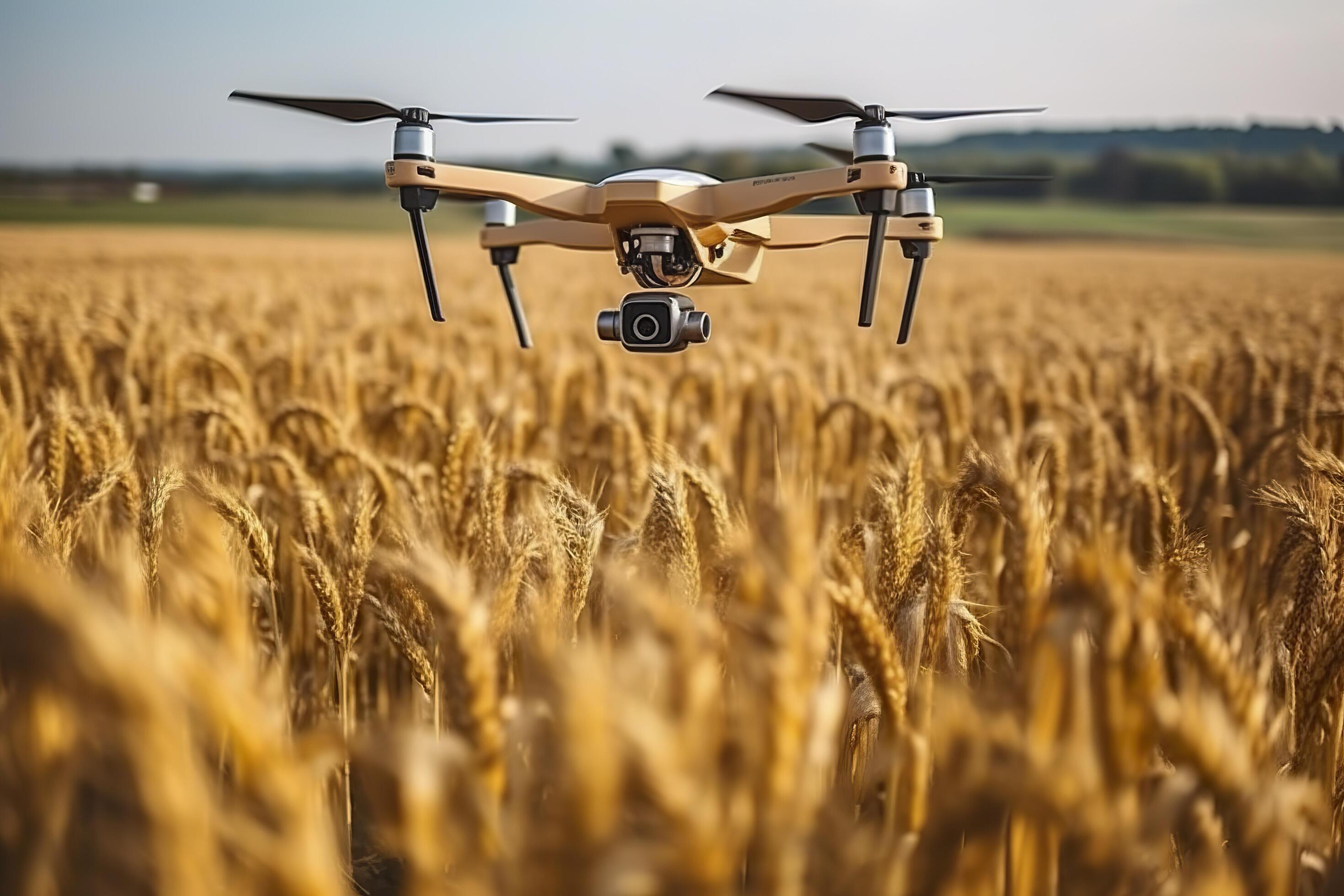
Farmers worldwide are increasingly turning to drone technology for precise crop monitoring. This innovative approach offers a powerful tool for assessing crop health, identifying issues like disease and stress, and optimizing resource allocation. Drones equipped with advanced sensors provide detailed aerial imagery, enabling a comprehensive view of the entire field, which was previously inaccessible or laborious to achieve with traditional methods.
This allows for timely interventions, potentially maximizing yields and minimizing environmental impact.
The technology goes beyond simply capturing images. Sophisticated data processing techniques transform these images into actionable insights for farmers, guiding them toward targeted interventions, such as precisely applying water and fertilizers where needed. This level of precision agriculture promises to revolutionize farming practices, making them more efficient and sustainable.
Introduction to Drone-Based Crop Monitoring
Drone technology is rapidly transforming agriculture, offering farmers a powerful tool for precise and efficient crop management. This innovative approach leverages unmanned aerial vehicles (UAVs), commonly known as drones, equipped with advanced sensors and imaging technologies to gather crucial data about crops. The data collected can provide valuable insights into crop health, yield potential, and overall farm productivity, leading to improved decision-making and optimized resource allocation.Drone-based crop monitoring relies on the principles of remote sensing, using aerial imagery to detect patterns and anomalies related to crop growth and health.
By analyzing this data, farmers can identify areas needing attention, such as nutrient deficiencies, pest infestations, or water stress, enabling proactive interventions to prevent potential losses. This approach differs significantly from traditional methods, allowing for more targeted and timely interventions, potentially maximizing yields and minimizing environmental impact.
Drone Types Used in Agriculture
Various drone types are tailored for different agricultural applications. The choice of drone depends on factors like payload capacity, flight time, and desired resolution of the imagery. Lightweight, smaller drones are ideal for smaller farms or specific tasks, while larger, more robust drones are suited for extensive monitoring over large fields.
Sensors and Imaging Technologies
Drones are equipped with a range of sensors and imaging technologies to capture detailed data about crops. Multispectral and hyperspectral cameras, capturing information across a wider range of the electromagnetic spectrum, are commonly used to identify subtle variations in crop health. Thermal cameras can detect temperature anomalies indicative of stress or disease. LiDAR (Light Detection and Ranging) technology can generate precise 3D models of the crop canopy, aiding in yield estimation and irrigation planning.
These advanced technologies, combined with powerful image processing algorithms, provide farmers with a wealth of information.
Comparison of Drone Types and Applications
| Drone Type | Sensor Type | Suitable Crops | Advantages | Disadvantages |
|---|---|---|---|---|
| Lightweight, fixed-wing drones | Multispectral cameras | Wide range of crops, including fruits, vegetables, and grains | Longer flight times, greater coverage area, relatively affordable | Lower resolution imagery compared to heavier drones, may not be suitable for detailed analysis of specific crops. |
| Quadcopter drones | Hyperspectral cameras, thermal cameras | High-value crops, precision agriculture applications | High maneuverability, flexible flight patterns, detailed imagery, suitable for smaller farms. | Shorter flight times, limited coverage area, higher cost per flight hour. |
| Helicopter drones | LiDAR sensors | Large-scale crop monitoring, 3D modeling of crop canopy | High-resolution 3D data, accurate yield estimations, effective for large fields. | High initial cost, specialized personnel required for operation. |
Data Acquisition and Processing
Drone-based crop monitoring is revolutionizing agricultural practices by providing detailed, high-resolution data about crops. This data, meticulously collected and processed, enables farmers to make informed decisions regarding irrigation, fertilization, and pest control, ultimately maximizing yields and minimizing resource use. Key to this process is the effective acquisition and analysis of data from aerial imagery.The process hinges on precisely capturing images of crops from the air and translating them into actionable insights for farmers.
Data processing involves intricate image analysis techniques that highlight subtle variations in crop health, allowing for early detection of stress factors and enabling proactive interventions. Different data formats, from raw image files to processed metrics, are crucial for efficient data handling and sharing.
Drone Data Collection Methods
Drone-based data collection leverages various technologies. High-resolution cameras mounted on drones capture detailed images of crop fields, recording spectral information reflecting different plant characteristics. Multispectral sensors, which capture data across multiple wavelengths, offer insights into vegetation health beyond the visible spectrum. Hyperspectral sensors, capable of capturing data across a broader range of wavelengths, provide even more granular information, enabling the detection of specific pigments and stressors.
These sensors are critical in gathering precise data, allowing farmers to monitor crop conditions in detail.
Image Processing and Data Analysis Procedures
Image processing procedures are essential for extracting meaningful information from drone-acquired imagery. This often involves pre-processing steps to remove noise, enhance image quality, and align different images captured over time. Techniques like geometric correction and radiometric calibration ensure accuracy and consistency in analysis. Following pre-processing, image segmentation isolates specific features within the images. This might involve distinguishing between healthy and stressed plants or identifying areas with different moisture levels.
Advanced algorithms are applied to interpret these segmented features, generating metrics such as vegetation indices (NDVI, EVI), biomass estimations, and crop health scores. The insights gleaned from this analysis are directly useful for making informed decisions.
Data Formats in Drone-Based Crop Monitoring
Various data formats are used in drone-based crop monitoring. Raw image files (e.g., GeoTIFF, JPEG) form the foundation, capturing the original sensor data. Processed data, often in tabular format (e.g., CSV, TXT), contains extracted metrics such as vegetation indices and health scores, enabling easier analysis and integration into existing farm management systems. These different formats allow for flexibility and compatibility with various software and tools.
Specific formats are crucial for efficient data storage and accessibility.
Converting Drone Images into Useful Data for Farmers
The transformation of drone images into useful data involves translating complex imagery into easily understandable metrics. Software tools convert the data into visual representations like heatmaps, highlighting areas of concern. These heatmaps visually demonstrate areas needing attention, facilitating targeted interventions. Furthermore, the processed data is often integrated into farm management software, enabling farmers to track crop health over time and monitor progress.
This integration allows for proactive adjustments to irrigation, fertilization, and pest control strategies, leading to improved yields and reduced costs.
Data Acquisition and Processing Pipeline Flowchart
[A flowchart illustrating the data acquisition and processing pipeline, depicting steps like image capture, pre-processing, image segmentation, feature extraction, and data analysis. The flowchart visually demonstrates the sequential steps, highlighting the input and output of each stage.]
Image Processing Techniques Summary
| Technique | Description | Application | Advantages | Disadvantages |
|---|---|---|---|---|
| Geometric Correction | Adjusts distortions in imagery due to sensor or flight variations. | Ensures accurate spatial analysis, location mapping. | Precise location data, accurate spatial relationships. | Computationally intensive, may not handle all distortion types perfectly. |
| Radiometric Calibration | Adjusts variations in image brightness due to sensor response or atmospheric conditions. | Ensures consistent and reliable measurements across different images and time periods. | Accurate measurements, consistent data. | Calibration procedures need to be carefully performed, may introduce bias. |
| Image Segmentation | Divides an image into distinct regions based on characteristics like color, texture, or shape. | Identifies specific features like crops, weeds, or water stress. | Targeted analysis, accurate feature identification. | Segmentation algorithms may misinterpret features, manual refinement may be needed. |
| Vegetation Index Calculation (e.g., NDVI) | Calculates a numerical value representing vegetation health. | Measures photosynthetic activity, assesses stress levels. | Rapid assessment of vegetation health, easy to interpret. | May be influenced by environmental factors, needs context for interpretation. |
Identifying Crop Health Issues
Drone-based crop monitoring provides a powerful tool for farmers to assess crop health, enabling early detection of potential issues. By analyzing visual cues from the air, drones can identify signs of stress, disease, and pest infestations, allowing for timely interventions and optimized resource allocation. This proactive approach can significantly improve yields and profitability.Drone imagery allows for a comprehensive overview of a field, revealing subtle patterns and variations that might be missed on the ground.
This aerial perspective provides a unique vantage point for identifying crop health anomalies, often pinpointing problem areas that would be difficult to spot otherwise. This remote sensing technology is proving to be invaluable for precision agriculture.
Indicators of Healthy and Unhealthy Crops
Healthy crops typically exhibit uniform green coloration, consistent canopy density, and a balanced growth pattern. This uniformity suggests optimal nutrient uptake and overall vigor. Conversely, unhealthy crops display noticeable variations in color, texture, and growth, indicating potential issues like stress, diseases, or pest infestations. These variations often manifest as discoloration, wilting, or stunted growth.
Visual Cues for Detecting Crop Stress, Diseases, and Pests
Drone imagery allows for detailed analysis of visual cues indicative of crop stress, diseases, and pests. Identifying stress, for example, involves recognizing variations in leaf color (yellowing, browning), leaf size (small or stunted leaves), and overall canopy structure (thinning or wilting). Disease detection relies on recognizing patterns of discoloration, lesions, or spots on leaves and stems. Pest infestations can be identified through the presence of large numbers of insects, insect damage (holes, chewed edges), or significant defoliation.
The specific appearance of these cues varies based on the crop type, the nature of the stressor, and the stage of the crop’s development.
How Drone Imagery Helps Identify Specific Crop Problems
Drone imagery provides detailed information for identifying specific crop problems. For instance, nutrient deficiencies often show up as specific patterns of discoloration across the field, allowing for targeted application of fertilizers. Disease outbreaks can be detected through the identification of characteristic patterns of lesions or spots on leaves and stems. Pest infestations are visible as areas of defoliation or as swarms of insects.
Examples of Different Types of Damage in Drone Images
Drone images reveal various types of damage. For example, fungal diseases might appear as localized areas of discoloration and leaf necrosis. Bacterial infections might manifest as water-soaked spots or lesions. Insect damage can range from small holes in leaves to significant defoliation. Nutrient deficiencies manifest in specific patterns of chlorosis, often with distinct bands or areas of yellowing.
Table of Crop Diseases and Their Visual Symptoms
| Disease | Visual Symptoms (Drone Imagery) | Impact on Crops |
|---|---|---|
| Late Blight (Potato) | Dark, irregular lesions on leaves and stems; rapid spread, often with a characteristic water-soaked appearance; may show as distinct, circular spots or areas of browning. | Significant yield reduction; complete crop loss if not managed effectively. |
| Fusarium Wilt (Tomato) | Yellowing and wilting of leaves, particularly in lower portions of the plant; often progresses to complete plant death; may show as distinct yellowing bands along the plant stem. | Reduced fruit yield and quality; can lead to complete crop failure in severe cases. |
| Leaf Spot (Soybeans) | Small, circular or irregular spots on leaves; spots may vary in color from light brown to dark brown, often with a distinct halo; the spots may be concentrated in specific areas of the field. | Reduced photosynthetic efficiency; loss of leaves; reduced yield. |
Precision Agriculture Applications
Drone-based crop monitoring is revolutionizing agricultural practices, moving beyond basic observation to enable precise interventions. This technology empowers farmers to optimize resource use, reduce waste, and enhance yields through targeted applications of water, fertilizer, and pesticides. The detailed data collected by drones allows for informed decisions that were previously impossible, marking a significant leap forward in agricultural efficiency and sustainability.
Targeted Irrigation and Fertilization
Drones equipped with multispectral sensors can map crop health and identify areas experiencing stress or nutrient deficiencies. This allows for targeted irrigation and fertilization, delivering resources precisely where needed. No longer are entire fields treated uniformly; instead, the precise needs of each section are met. This approach conserves water and fertilizer, reducing environmental impact while maximizing crop growth.
For example, a drone might detect a patch of a field experiencing nitrogen deficiency. This information enables farmers to apply fertilizer only to that specific area, preventing unnecessary use of resources across the entire field.
Variable Rate Application
Drone-based monitoring enables variable rate application of inputs, a crucial aspect of precision agriculture. Using the data collected by drones, farmers can tailor the amount of irrigation, fertilizer, or pesticide to the specific needs of different areas within a field. This data-driven approach is far more effective than traditional, broad-scale applications. This targeted approach leads to significant cost savings and reduced environmental impact, by minimizing wasted resources.
For instance, a farmer might apply a higher dose of fertilizer to a section of the field experiencing lower nutrient levels, while applying a lower dose to areas with adequate nutrient content.
Optimizing Yield and Resource Utilization
Drone imagery helps identify potential yield-limiting factors early on, enabling timely interventions. This allows for proactive management, preventing losses and optimizing resource use. For example, early detection of pests or diseases using drone-based monitoring enables prompt treatment, preventing widespread infestation. By using drone data to monitor crop health and growth patterns, farmers can identify areas with varying levels of vigor, adjust their management practices, and improve overall yield and resource efficiency.
This data also helps farmers make informed decisions regarding irrigation scheduling and nutrient application, optimizing water and fertilizer usage.
Crop Management Decision-Making
Drone-based monitoring provides crucial data for informed crop management decisions. By analyzing the collected data, farmers can optimize planting strategies, irrigation schedules, and fertilization regimes. This data-driven approach enables timely and effective interventions, ultimately enhancing yield and profitability. Real-time analysis of drone data allows farmers to identify issues and respond quickly, preventing potential losses. Furthermore, this data facilitates long-term planning and helps farmers adapt to changing environmental conditions.
Drones empower precision agriculture, leading to optimized resource use, minimized environmental impact, and increased crop yields. This technology transforms farming from a broad-stroke approach to a highly targeted and efficient process, allowing farmers to respond proactively to changing conditions and maximize their profits.
Economic and Environmental Impact
Drone-based crop monitoring is rapidly transforming agriculture, offering significant economic and environmental advantages over traditional methods. Farmers are increasingly recognizing the potential for increased yields, reduced costs, and a more sustainable approach to farming. This shift towards precision agriculture promises to revolutionize how crops are managed.This innovative approach to monitoring allows for real-time data analysis, enabling proactive adjustments to cultivation strategies.
This precision leads to optimized resource allocation and minimized waste, ultimately contributing to both economic gains and environmental stewardship. The economic and environmental benefits are increasingly apparent, prompting wider adoption of drone technology in agricultural practices.
Economic Benefits of Drone-Based Monitoring
Drone technology offers a cost-effective solution for large-scale crop assessments, replacing costly and time-consuming manual surveys. By identifying issues like nutrient deficiencies or pest infestations early, farmers can implement targeted interventions, preventing widespread damage and optimizing yields. This early detection and rapid response significantly reduces losses, translating into higher profits. Drone-based mapping allows for accurate yield predictions, enabling farmers to adjust planting and harvesting strategies for maximum efficiency.
Environmental Benefits of Reduced Resource Usage
Drone-based monitoring contributes to sustainable agriculture by reducing the environmental footprint of traditional methods. The use of drones minimizes the need for extensive field travel by ground vehicles, reducing fuel consumption and greenhouse gas emissions. By precisely identifying areas requiring specific interventions, drone technology minimizes the use of fertilizers and pesticides, thereby reducing water and soil contamination. This targeted approach enhances soil health and biodiversity, promoting a more sustainable ecosystem.
Cost-Effectiveness of Drone-Based Monitoring
While initial investment in drone technology might seem substantial, the long-term cost-effectiveness is compelling. Drone-based monitoring significantly reduces labor costs associated with manual surveys and crop inspections. The quicker identification and resolution of issues translate into minimized crop losses, resulting in higher returns on investment. Precision application of inputs, made possible by drone data, reduces waste and maximizes the efficiency of resources, further enhancing the cost-effectiveness of the approach.
Successful Implementations of Drone-Based Monitoring
Numerous farms across the globe have successfully integrated drone-based monitoring into their operations. For instance, a California vineyard utilized drones to monitor vine health, identifying early signs of stress and disease. This proactive approach allowed for timely intervention, preventing widespread infection and maintaining high-quality yields. Another example is a large-scale soybean farm in the Midwest that employed drones for yield estimation and fertilizer application.
This enabled the farm to optimize resource utilization and enhance overall profitability.
Find out further about the benefits of drone technology applications in precision agriculture that can provide significant benefits.
Scalability and Widespread Adoption Potential
The potential for widespread adoption of drone-based crop monitoring is significant. As the technology continues to improve and costs decrease, more farmers will be able to integrate it into their operations. Furthermore, the development of user-friendly platforms and accessible data analysis tools will encourage wider adoption across diverse farming landscapes and scales.
Comparison of Costs and Benefits
| Aspect | Traditional Method | Drone-Based Method |
|---|---|---|
| Cost | $5,000 – $10,000 per season (labor, travel, etc.) | $2,000 – $5,000 per season (drone purchase/rental, software) |
| Time Efficiency | Days to weeks for large fields | Hours for large fields |
| Resource Usage | High fuel consumption, potential for increased fertilizer/pesticide use | Reduced fuel consumption, optimized resource use |
This table provides a preliminary comparison; actual costs and benefits may vary depending on the specific farm, scale of operations, and drone technology employed.
Future Trends and Challenges
Drone-based crop monitoring is rapidly evolving, promising greater precision and efficiency in agriculture. However, realizing its full potential requires navigating emerging trends and addressing existing challenges. This transition necessitates a clear understanding of the technology’s strengths, limitations, and future trajectory.
Emerging Trends in Drone Technology
Drone technology is advancing at a rapid pace, incorporating more sophisticated sensors and data processing capabilities. This leads to higher resolution imagery, enhanced data analysis, and improved decision-making for farmers. Multispectral and hyperspectral imaging, capable of capturing a broader range of light wavelengths, provides valuable insights into plant health and stress indicators. The integration of artificial intelligence (AI) and machine learning (ML) algorithms is another key trend, enabling automated analysis of vast datasets and the identification of subtle patterns indicative of disease or nutrient deficiencies.
Challenges and Limitations of Current Drone Technology
Despite the advancements, current drone technology faces certain limitations. Battery life remains a significant constraint, restricting the flight time and area coverage of drones. Weather conditions, such as rain, fog, or strong winds, can disrupt data collection. The need for skilled operators and specialized software for data analysis adds to the operational costs. Ensuring data security and privacy is also a growing concern as drone-based monitoring systems collect sensitive information about farms.
Furthermore, the standardization of data formats and protocols is crucial for seamless data sharing and integration across different systems.
Ongoing Research and Development
Researchers are actively working to address the limitations of current drone technology. One area of focus is developing more robust and energy-efficient drone designs. Advancements in sensor technology are also being pursued, aiming to improve the quality and resolution of images and data captured. Researchers are exploring new methods for automating data processing and analysis, reducing reliance on manual intervention.
These advancements are crucial for scaling drone-based crop monitoring and making it more accessible to a wider range of farmers.
Future Potential of Drone Technology in Agriculture
Drone-based crop monitoring holds significant potential for revolutionizing agricultural practices. It allows for proactive management of crop health, leading to improved yields and reduced input costs. Precision application of fertilizers and pesticides, targeted to specific areas of need, is a key application. Real-time monitoring enables timely interventions, minimizing crop losses due to disease or stress. Furthermore, the ability to monitor large tracts of land from above provides crucial insights for effective resource management and sustainable agriculture practices.
Integration of AI and Machine Learning with Drone Data
AI and machine learning algorithms are transforming the analysis of drone-based data. These algorithms can identify subtle patterns and anomalies in crop health indicators that might be missed by human observation. Machine learning models can be trained on vast datasets of drone imagery and historical crop data to predict future yields and potential issues, allowing farmers to proactively address potential problems.
AI-powered image analysis can automate tasks like identifying diseased plants, assessing nutrient deficiencies, and detecting pests, freeing up valuable time and resources for farmers.
Future Potential Applications and Research Directions
| Application | Research Direction |
|---|---|
| Improved yield prediction | Developing more sophisticated machine learning models that incorporate environmental data and historical yield records |
| Early disease detection | Developing AI-powered image recognition systems that can distinguish between healthy and diseased plants based on subtle visual cues |
| Targeted pesticide application | Developing algorithms that can map areas of disease or pest infestation, enabling precision spraying |
| Precision irrigation | Developing drone-based systems that can assess soil moisture levels and provide real-time irrigation recommendations |
| Improved resource management | Developing integrated systems that combine drone data with weather forecasts and soil data for optimized resource allocation |
Last Recap

In conclusion, drone-based crop monitoring offers a transformative approach to precision agriculture. By enabling detailed assessments of crop health, targeted interventions, and optimized resource use, this technology holds significant promise for increasing agricultural productivity and sustainability. While challenges remain, the continued advancements in drone technology and data analysis techniques are poised to further enhance the effectiveness of this approach in the coming years, paving the way for a more sustainable and efficient future of farming.